Area Overview for SO51 6FS
Photos of SO51 6FS
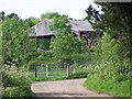
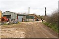

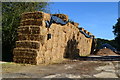
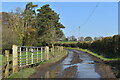
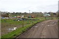
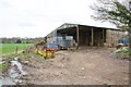
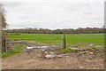
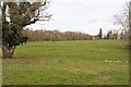
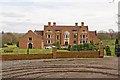
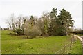
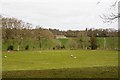
12 photos from this area
Area Information
Key information about the SO51 6FS including its size, population, and administrative classification.
- Area Type
- Postcode
- Area Size
- 3.1 km²
- Population
- 1557
- Population Density
- 168 people/km²
House Prices in SO51 6FS
52
Properties
£758,750
Average Sold Price
£130,000
Lowest Price
£1,535,000
Highest Price
Showing 52 properties
| Address | Type | Beds | Baths | Last Sale Price | Last Sale Date | |
|---|---|---|---|---|---|---|
| Greenvale Farm, Melchet Park, Sherfield English, SO51 6FS | Bungalow | 5 | 2 | £850,000 | Sep 2025 | |
| Broxmore Farm Cottage, Bunny Lane, Sherfield English, SO51 6FS | Detached | 3 | 2 | £580,000 | Apr 2022 | |
| Robin Hill, Broxmore Lane, Sherfield English, SO51 6FS | Detached | - | - | £820,000 | Mar 2021 | |
| Broxmore Barn, Bunny Lane, Sherfield English, SO51 6FS | Detached | 4 | 3 | £940,000 | Jul 2018 | |
| Winter House, Melchet Park, Sherfield English, SO51 6FS | Detached | 6 | 2 | £1,535,000 | Mar 2018 | |
| West Lodge, Salisbury Road, Sherfield English, SO51 6FS | house | 5 | - | £520,000 | Jul 2013 | |
| Seymour Barn, Bunny Lane, Sherfield English, SO51 6FS | Detached | - | - | £695,000 | Oct 2004 | |
| Greenvale Cottage, Melchet Park, Sherfield English, SO51 6FS | Bungalow | - | - | £130,000 | Nov 1999 | |
| Melchet Park Farm, Melchet Park, Sherfield English, SO51 6FS | Land | - | - | - | - | |
| Melchet Farm Cottage 2, Melchet Court, The Drive, Sherfield English, SO51 6FS | undefined | - | - | - | - |
Page 1 of 6
Energy Efficiency in SO51 6FS
Amenities
Schools
| Rank | School | Type | Entry gender | Ages |
|---|
Explore more schools in this area
Go to Schools tabDemographics
Household Size
Two person
most common
Accommodation Type
Houses
most common
Tenure
77
majority
Ethnic Group
White
most common
Religion
N/A
most common
Household Composition
N/A
most common
Age
47
median
Adults (30-64 years)
most common
Household Deprivation
N/A
with no deprivation
NS-SEC
46
in Lower managerial occupations
Explore more demographic insights in this area
Go to Demographics tabPlanning
Planning Constraints
- Flood RiskPremium
- Ramsar Wetland SitesPremium
- Area of Outstanding Natural BeautyPremium
- Protected Nature ReservePremium
- Protected WoodlandPremium