Area Overview for SP4 6LR
Photos of SP4 6LR
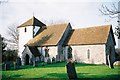
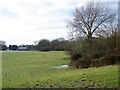
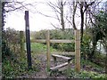
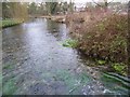
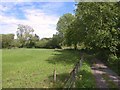
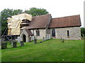
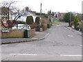

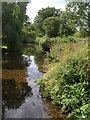
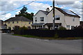
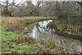
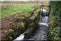
28 photos from this area
Area Information
Key information about the SP4 6LR including its size, population, and administrative classification.
- Area Type
- Postcode
- Area Size
- 16.0 hectares
- Population
- 1455
- Population Density
- 327 people/km²
House Prices in SP4 6LR
23
Properties
£355,667
Average Sold Price
£50,000
Lowest Price
£775,000
Highest Price
Showing 23 properties
| Address | Type | Beds | Baths | Last Sale Price | Last Sale Date | |
|---|---|---|---|---|---|---|
| Pachumba, Gomeldon Road, Winterbourne Gunner, SP4 6LR | Bungalow | 6 | 3 | £775,000 | Jan 2024 | |
| Chumleigh, Gomeldon Road, Winterbourne Gunner, SP4 6LR | Bungalow | 4 | 2 | £545,000 | Mar 2023 | |
| Shaleen, Gomeldon Road, Winterbourne Gunner, SP4 6LR | Detached | 2 | 1 | £315,000 | Dec 2019 | |
| Arolla, Gomeldon Road, Winterbourne Gunner, SP4 6LR | Bungalow | - | - | £510,000 | Aug 2018 | |
| Hillview, Gomeldon Road, Winterbourne Gunner, SP4 6LR | house | 3 | - | £375,000 | Dec 2017 | |
| Highpost View, Gomeldon Road, Winterbourne Gunner, SP4 6LR | house | - | - | £310,000 | Nov 2015 | |
| Meadow Rise, Gomeldon Road, Winterbourne Gunner, SP4 6LR | Bungalow | 3 | 2 | £315,000 | Jul 2015 | |
| The Bungalow, Gomeldon Road, Winterbourne Gunner, SP4 6LR | Bungalow | - | - | £359,000 | Sep 2008 | |
| Springfield, Gomeldon Road, Winterbourne Gunner, SP4 6LR | Detached | - | - | £420,000 | Feb 2007 | |
| Chesterton, Gomeldon Road, Winterbourne Gunner, SP4 6LR | Detached | - | - | £165,000 | Dec 1999 |
Page 1 of 3
Energy Efficiency in SP4 6LR
Amenities
Schools
| Rank | School | Type | Entry gender | Ages |
|---|
Explore more schools in this area
Go to Schools tabDemographics
Household Size
Two person
most common
Accommodation Type
Houses
most common
Tenure
76
majority
Ethnic Group
White
most common
Religion
N/A
most common
Household Composition
N/A
most common
Age
47
median
Adults (30-64 years)
most common
Household Deprivation
N/A
with no deprivation
NS-SEC
42
in Lower managerial occupations
Explore more demographic insights in this area
Go to Demographics tabPlanning
Planning Constraints
- Flood RiskPremium
- Ramsar Wetland SitesPremium
- Area of Outstanding Natural BeautyPremium
- Protected Nature ReservePremium
- Protected WoodlandPremium