Area Overview for SN9 5PS
Photos of SN9 5PS
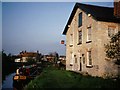
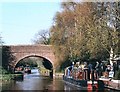
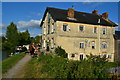
![Honey Street Farm [1] in SN9 5PS](https://images.propbar.co.uk/images/geograph/44/97/4497550_120.jpg)

79 photos from this area
Area Information
Key information about the SN9 5PS including its size, population, and administrative classification.
- Area Type
- Postcode
- Area Size
- 1.4 km²
- Population
- 1707
- Population Density
- 33 people/km²
House Prices in SN9 5PS
25
Properties
£430,208
Average Sold Price
£245,000
Lowest Price
£830,000
Highest Price
Showing 25 properties
| Address | Type | Beds | Baths | Last Sale Price | Last Sale Date | |
|---|---|---|---|---|---|---|
| Canal Cottage, Road Off Honeystreet South Of Canal, Honeystreet, SN9 5PS | house | - | - | £245,000 | Mar 2020 | |
| Sunhaven, Road Off Honeystreet North Of Canal, Honeystreet, SN9 5PS | Bungalow | - | - | £280,000 | Jul 2019 | |
| Clock House, Road Off Honeystreet North Of Canal, Honeystreet, SN9 5PS | house | - | - | £538,000 | Dec 2018 | |
| Summer Down House, Road Off Honeystreet North Of Canal, Honeystreet, SN9 5PS | Detached | 6 | 4 | £830,000 | Dec 2018 | |
| The Whiffle Tree, Road Off Honeystreet North Of Canal, Honeystreet, SN9 5PS | Detached | - | - | £380,000 | Dec 2005 | |
| End Cottage, Road Off Honeystreet North Of Canal, Honeystreet, SN9 5PS | Semi-detached | - | - | £308,250 | Jun 2004 | |
| Anchor Cottage, Road Off Honeystreet South Of Canal, Honeystreet, SN9 5PS | Detached | 4 | 2 | - | - | |
| Millside, Road Off Honeystreet North Of Canal, Honeystreet, SN9 5PS | Detached | 4 | 4 | - | - | |
| Foremans Cottage, Road Off Honeystreet North Of Canal, Honeystreet, SN9 5PS | Detached | 4 | 2 | - | - | |
| Honeystreet House, Road Off Honeystreet South Of Canal, Honeystreet, SN9 5PS | Land | - | - | - | - |
Page 1 of 3
Energy Efficiency in SN9 5PS
Amenities
Schools
| Rank | School | Type | Entry gender | Ages |
|---|
Explore more schools in this area
Go to Schools tabDemographics
Household Size
Two person
most common
Accommodation Type
Houses
most common
Tenure
71
majority
Ethnic Group
White
most common
Religion
N/A
most common
Household Composition
N/A
most common
Age
47
median
Adults (30-64 years)
most common
Household Deprivation
N/A
with no deprivation
NS-SEC
46
in Lower managerial occupations
Explore more demographic insights in this area
Go to Demographics tabPlanning
Planning Constraints
- Flood RiskPremium
- Ramsar Wetland SitesPremium
- Area of Outstanding Natural BeautyPremium
- Protected Nature ReservePremium
- Protected WoodlandPremium