Area Overview for SN9 5PL
Photos of SN9 5PL

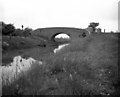

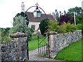
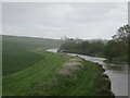
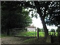


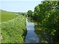
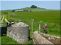
31 photos from this area
Area Information
Key information about the SN9 5PL including its size, population, and administrative classification.
- Area Type
- Postcode
- Area Size
- 1.6 km²
- Population
- 1707
- Population Density
- 33 people/km²
House Prices in SN9 5PL
50
Properties
£522,960
Average Sold Price
£85,000
Lowest Price
£1,500,000
Highest Price
Showing 50 properties
| Address | Type | Beds | Baths | Last Sale Price | Last Sale Date | |
|---|---|---|---|---|---|---|
| Old Station House, Woodborough, Woodborough, SN9 5PL | Detached | 4 | 1 | £775,000 | Jul 2024 | |
| The Old Post Office, Woodborough, Woodborough, SN9 5PL | Terraced | 3 | 2 | £388,500 | Feb 2024 | |
| Shamrock, Church Road, Woodborough, SN9 5PL | house | 3 | 1 | £530,000 | Nov 2023 | |
| Rose Farm House, Smithy Lane, Woodborough, SN9 5PL | Detached | 4 | 2 | £925,000 | Aug 2023 | |
| Brandrith, C 38 North From Smithy Lane Junction To The Sands, Woodborough, SN9 5PL | Bungalow | 4 | 2 | £485,000 | Jul 2023 | |
| Amberley, Woodborough, Woodborough, SN9 5PL | Bungalow | 3 | 2 | £615,000 | Apr 2022 | |
| Bonnington House, Woodborough, Woodborough, SN9 5PL | Detached | 5 | - | £1,217,691 | Feb 2022 | |
| The Nook, Woodborough, Woodborough, SN9 5PL | house | - | - | £745,000 | Apr 2021 | |
| Donkey Meadow, Woodborough, Woodborough, SN9 5PL | house | - | - | £780,000 | Sep 2019 | |
| Highbank, Woodborough, Woodborough, SN9 5PL | Detached | - | - | £835,000 | May 2019 |
Page 1 of 5
Energy Efficiency in SN9 5PL
Amenities
Schools
| Rank | School | Type | Entry gender | Ages |
|---|
Explore more schools in this area
Go to Schools tabDemographics
Household Size
Two person
most common
Accommodation Type
Houses
most common
Tenure
71
majority
Ethnic Group
White
most common
Religion
N/A
most common
Household Composition
N/A
most common
Age
47
median
Adults (30-64 years)
most common
Household Deprivation
N/A
with no deprivation
NS-SEC
46
in Lower managerial occupations
Explore more demographic insights in this area
Go to Demographics tabPlanning
Planning Constraints
- Flood RiskPremium
- Ramsar Wetland SitesPremium
- Area of Outstanding Natural BeautyPremium
- Protected Nature ReservePremium
- Protected WoodlandPremium