Area Overview for SN9 5NS
Photos of SN9 5NS
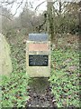


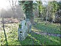


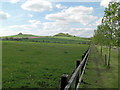

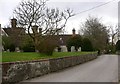

32 photos from this area
Area Information
Key information about the SN9 5NS including its size, population, and administrative classification.
- Area Type
- Postcode
- Area Size
- 51.6 hectares
- Population
- 1707
- Population Density
- 33 people/km²
House Prices in SN9 5NS
36
Properties
£470,686
Average Sold Price
£100,000
Lowest Price
£1,400,000
Highest Price
Showing 36 properties
| Address | Type | Beds | Baths | Last Sale Price | Last Sale Date | |
|---|---|---|---|---|---|---|
| Paradise Cottage, Alton Road Road Joining From North East From Church And Manor Farm, Wilcot, SN9 5NS | house | - | - | £1,400,000 | May 2025 | |
| The Old Post Office, Alton Road Road Joining From North East From Church And Manor Farm, Wilcot, SN9 5NS | Detached | 3 | 2 | £575,000 | Jan 2025 | |
| 52 Wilcot Green, Wilcot, SN9 5NS | Cottage | 2 | 2 | £300,000 | Mar 2023 | |
| Glebe House, Alton Road Road Joining From North East From Church And Manor Farm, Wilcot, SN9 5NS | Detached | 3 | 1 | £390,000 | Aug 2020 | |
| Foxlegh House, Wilcot Green, Wilcot, SN9 5NS | Detached | - | - | £677,500 | Nov 2019 | |
| 49 Wilcot Green, Wilcot, SN9 5NS | Semi-detached | 3 | 2 | £450,000 | Jun 2018 | |
| 45 Wilcot Green, Wilcot, SN9 5NS | Semi-detached | 2 | 1 | £393,596 | Oct 2017 | |
| Clon Moyle, 28 Wilcot Green, Wilcot, SN9 5NS | Semi-detached | - | - | £450,000 | May 2016 | |
| Hollybush House, Alton Road Road Joining From North East From Church And Manor Farm, Wilcot, SN9 5NS | Detached | 5 | 3 | £690,000 | Jul 2015 | |
| Bread Oven Cottage, 25 Wilcot Green, Wilcot, SN9 5NS | Semi-detached | 2 | 1 | £272,500 | Oct 2013 |
Page 1 of 4
Energy Efficiency in SN9 5NS
Amenities
Schools
| Rank | School | Type | Entry gender | Ages |
|---|
Explore more schools in this area
Go to Schools tabDemographics
Household Size
Two person
most common
Accommodation Type
Houses
most common
Tenure
71
majority
Ethnic Group
White
most common
Religion
N/A
most common
Household Composition
N/A
most common
Age
47
median
Adults (30-64 years)
most common
Household Deprivation
N/A
with no deprivation
NS-SEC
46
in Lower managerial occupations
Explore more demographic insights in this area
Go to Demographics tabPlanning
Planning Constraints
- Flood RiskPremium
- Ramsar Wetland SitesPremium
- Area of Outstanding Natural BeautyPremium
- Protected Nature ReservePremium
- Protected WoodlandPremium