Area Overview for SN8 4WL
Photos of SN8 4WL
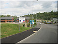
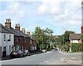
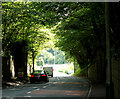
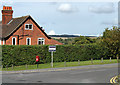
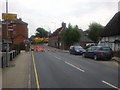
100 photos from this area
Area Information
Key information about the SN8 4WL including its size, population, and administrative classification.
- Area Type
- Postcode
- Area Size
- 4.7 hectares
- Population
- 2568
- Population Density
- 2636 people/km²
House Prices in SN8 4WL
47
Properties
£530,390
Average Sold Price
£359,950
Lowest Price
£834,950
Highest Price
Showing 47 properties
| Address | Type | Beds | Baths | Last Sale Price | Last Sale Date | |
|---|---|---|---|---|---|---|
| 19 Jennings Road, Marlborough, SN8 4WL | Retail | 3 | 1 | £450,000 | Mar 2025 | |
| 21 Jennings Road, Marlborough, SN8 4WL | Detached | 4 | 2 | £560,000 | May 2023 | |
| 26 Jennings Road, Marlborough, SN8 4WL | house | - | - | £834,950 | Mar 2022 | |
| 24 Jennings Road, Marlborough, SN8 4WL | house | - | - | £549,950 | Dec 2021 | |
| 20 Jennings Road, Marlborough, SN8 4WL | house | - | - | £395,000 | Mar 2021 | |
| 42 Jennings Road, Marlborough, SN8 4WL | house | - | - | £704,950 | Mar 2021 | |
| 44 Jennings Road, Marlborough, SN8 4WL | house | - | - | £629,950 | Feb 2021 | |
| 46 Jennings Road, Marlborough, SN8 4WL | house | - | - | £689,950 | Feb 2021 | |
| 40 Jennings Road, Marlborough, SN8 4WL | house | - | - | £654,950 | Dec 2020 | |
| 36 Jennings Road, Marlborough, SN8 4WL | house | - | - | £394,450 | Oct 2020 |
Page 1 of 5
Energy Efficiency in SN8 4WL
Amenities
Schools
| Rank | School | Type | Entry gender | Ages |
|---|
Explore more schools in this area
Go to Schools tabDemographics
Household Size
One person
most common
Accommodation Type
Houses
most common
Tenure
65
majority
Ethnic Group
White
most common
Religion
N/A
most common
Household Composition
N/A
most common
Age
22
median
Young Adults (15-29 years)
most common
Household Deprivation
N/A
with no deprivation
NS-SEC
30
in Lower managerial occupations
Explore more demographic insights in this area
Go to Demographics tabPlanning
Planning Constraints
- Flood RiskPremium
- Ramsar Wetland SitesPremium
- Area of Outstanding Natural BeautyPremium
- Protected Nature ReservePremium
- Protected WoodlandPremium