Area Overview for SN8 4AS
Photos of SN8 4AS
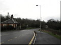
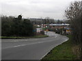
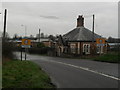
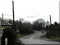
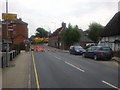
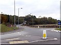
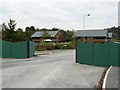
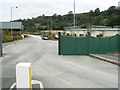
100 photos from this area
Area Information
Key information about the SN8 4AS including its size, population, and administrative classification.
- Area Type
- Postcode
- Area Size
- 3.3 hectares
- Population
- 2568
- Population Density
- 2636 people/km²
House Prices in SN8 4AS
58
Properties
£413,536
Average Sold Price
£52,000
Lowest Price
£835,000
Highest Price
Showing 58 properties
| Address | Type | Beds | Baths | Last Sale Price | Last Sale Date | |
|---|---|---|---|---|---|---|
| 59 Cherry Orchard, Marlborough, SN8 4AS | Bungalow | 4 | 3 | £835,000 | Mar 2025 | |
| 42 Cherry Orchard, Marlborough, SN8 4AS | Semi-detached | 3 | 1 | £285,000 | May 2024 | |
| 15, Cherry Orchard House, Cherry Orchard, Marlborough, SN8 4AS | Flat | - | - | £258,000 | May 2023 | |
| 10, Cherry Orchard House, Cherry Orchard, Marlborough, SN8 4AS | Flat | - | - | £260,000 | May 2023 | |
| 32 Cherry Orchard, Marlborough, SN8 4AS | Semi-detached | 3 | 1 | £310,000 | Feb 2023 | |
| 6, Cherry Orchard House, Cherry Orchard, Marlborough, SN8 4AS | Flat | 3 | 2 | £295,000 | Feb 2023 | |
| Willow Tree House, Cherry Orchard, Marlborough, SN8 4AS | house | - | - | £410,000 | Jan 2022 | |
| Hillcrest House, Cherry Orchard, Marlborough, SN8 4AS | Detached | 4 | 2 | £615,000 | Sep 2020 | |
| Bardon Hill House, Cherry Orchard, Marlborough, SN8 4AS | house | 4 | - | £617,500 | Jun 2019 | |
| Meadow Sweet, 56 Cherry Orchard, Marlborough, SN8 4AS | Bungalow | 3 | 2 | £590,000 | May 2018 |
Page 1 of 6
Energy Efficiency in SN8 4AS
Amenities
Schools
| Rank | School | Type | Entry gender | Ages |
|---|
Explore more schools in this area
Go to Schools tabDemographics
Household Size
One person
most common
Accommodation Type
Houses
most common
Tenure
65
majority
Ethnic Group
White
most common
Religion
N/A
most common
Household Composition
N/A
most common
Age
22
median
Young Adults (15-29 years)
most common
Household Deprivation
N/A
with no deprivation
NS-SEC
30
in Lower managerial occupations
Explore more demographic insights in this area
Go to Demographics tabPlanning
Planning Constraints
- Flood RiskPremium
- Ramsar Wetland SitesPremium
- Area of Outstanding Natural BeautyPremium
- Protected Nature ReservePremium
- Protected WoodlandPremium