Area Overview for SN8 4HH
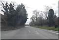
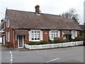
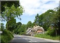
Photos of SN8 4HH
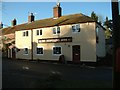
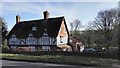
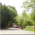
![Driveway to Manton Grange [1] in SN8 4HH](https://images.propbar.co.uk/images/geograph/53/34/5334025_120.jpg)

99 photos from this area
Area Information
Key information about the SN8 4HH including its size, population, and administrative classification.
- Area Type
- Postcode
- Area Size
- 16.4 hectares
- Population
- 1205
- Population Density
- 591 people/km²
House Prices in SN8 4HH
37
Properties
£425,817
Average Sold Price
£95,000
Lowest Price
£870,000
Highest Price
Showing 37 properties
| Address | Type | Beds | Baths | Last Sale Price | Last Sale Date | |
|---|---|---|---|---|---|---|
| Welcome, High Street, Manton, SN8 4HH | Detached | 4 | 2 | £415,000 | Dec 2025 | |
| West Lodge, High Street, Manton, SN8 4HH | Semi-detached | 4 | 2 | £800,000 | Jul 2025 | |
| 23 High Street, Manton, SN8 4HH | Semi-detached | 4 | 2 | £625,000 | Dec 2023 | |
| Hope Cottage, 24 High Street, Manton, SN8 4HH | house | 3 | - | £615,000 | Nov 2023 | |
| The Old Post Office, 2 High Street, Manton, SN8 4HH | Semi-detached | 4 | - | £747,500 | May 2023 | |
| 21 High Street, Manton, SN8 4HH | house | - | - | £320,000 | Jun 2021 | |
| Scrumpety Burrows, High Street, Manton, SN8 4HH | house | 5 | - | £870,000 | Nov 2020 | |
| 11 High Street, Manton, SN8 4HH | Terraced | 3 | 2 | £289,000 | Dec 2017 | |
| 8 High Street, Manton, SN8 4HH | Detached | 2 | 1 | £300,000 | Dec 2016 | |
| Teal Cottage, High Street, Manton, SN8 4HH | Semi-detached | - | - | £695,000 | Oct 2016 |
Page 1 of 4
Energy Efficiency in SN8 4HH
Amenities
Schools
| Rank | School | Type | Entry gender | Ages |
|---|
Explore more schools in this area
Go to Schools tabDemographics
Household Size
Two person
most common
Accommodation Type
Houses
most common
Tenure
83
majority
Ethnic Group
White
most common
Religion
N/A
most common
Household Composition
N/A
most common
Age
47
median
Adults (30-64 years)
most common
Household Deprivation
N/A
with no deprivation
NS-SEC
55
in Lower managerial occupations
Explore more demographic insights in this area
Go to Demographics tabPlanning
Planning Constraints
- Flood RiskPremium
- Ramsar Wetland SitesPremium
- Area of Outstanding Natural BeautyPremium
- Protected Nature ReservePremium
- Protected WoodlandPremium