Area Overview for SN8 2PT
Photos of SN8 2PT
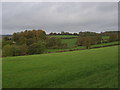
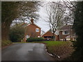
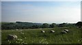
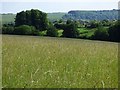
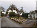
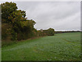
6 photos from this area
Area Information
Key information about the SN8 2PT including its size, population, and administrative classification.
- Area Type
- Postcode
- Area Size
- 11.6 hectares
- Population
- 1540
- Population Density
- 502 people/km²
House Prices in SN8 2PT
24
Properties
£480,429
Average Sold Price
£164,000
Lowest Price
£1,490,000
Highest Price
Showing 24 properties
| Address | Type | Beds | Baths | Last Sale Price | Last Sale Date | |
|---|---|---|---|---|---|---|
| Tanglewood, Crowood Lane, Ramsbury, SN8 2PT | Detached | 4 | 1 | £710,000 | May 2025 | |
| Arconia, Crowood Lane, Ramsbury, SN8 2PT | Detached | 4 | 2 | £865,000 | Mar 2024 | |
| 6 Crowood Lane, Ramsbury, SN8 2PT | Terraced | 2 | 1 | £277,000 | Dec 2023 | |
| Harefield, Crowood Lane, Ramsbury, SN8 2PT | house | - | - | £1,490,000 | Sep 2020 | |
| 8 Crowood Lane, Ramsbury, SN8 2PT | Terraced | 2 | 1 | £310,000 | Aug 2020 | |
| Cherwell House, 3 Crowood Lane, Ramsbury, SN8 2PT | Detached | 5 | 3 | £250,000 | Apr 2019 | |
| 7 Crowood Lane, Ramsbury, SN8 2PT | house | - | - | £285,000 | Aug 2017 | |
| 4 Crowood Lane, Ramsbury, SN8 2PT | Semi-detached | 2 | 1 | £164,000 | Mar 2011 | |
| Forge Cottage, 10 Crowood Lane, Ramsbury, SN8 2PT | Bungalow | 4 | - | £535,000 | Nov 2010 | |
| Pear Tree Cottage, 2 Crowood Lane, Ramsbury, SN8 2PT | Detached | - | - | £365,000 | Jan 2010 |
Page 1 of 3
Energy Efficiency in SN8 2PT
Amenities
Schools
| Rank | School | Type | Entry gender | Ages |
|---|
Explore more schools in this area
Go to Schools tabDemographics
Household Size
Two person
most common
Accommodation Type
Houses
most common
Tenure
69
majority
Ethnic Group
White
most common
Religion
N/A
most common
Household Composition
N/A
most common
Age
47
median
Adults (30-64 years)
most common
Household Deprivation
N/A
with no deprivation
NS-SEC
44
in Lower managerial occupations
Explore more demographic insights in this area
Go to Demographics tabPlanning
Planning Constraints
- Flood RiskPremium
- Ramsar Wetland SitesPremium
- Area of Outstanding Natural BeautyPremium
- Protected Nature ReservePremium
- Protected WoodlandPremium