Area Overview for SN8 2PS
Photos of SN8 2PS
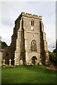
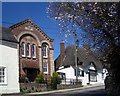
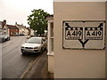
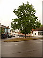
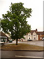
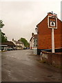
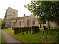
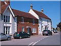
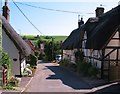
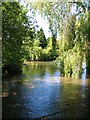
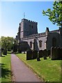

100 photos from this area
Area Information
Key information about the SN8 2PS including its size, population, and administrative classification.
- Area Type
- Postcode
- Area Size
- 1.4 hectares
- Population
- 1540
- Population Density
- 502 people/km²
House Prices in SN8 2PS
20
Properties
£493,532
Average Sold Price
£200,100
Lowest Price
£870,000
Highest Price
Showing 20 properties
| Address | Type | Beds | Baths | Last Sale Price | Last Sale Date | |
|---|---|---|---|---|---|---|
| Ayodele, 38 Oxford Street, Ramsbury, SN8 2PS | Cottage | 4 | 3 | £785,000 | Apr 2022 | |
| Penny Cottage, 17 Oxford Street, Ramsbury, SN8 2PS | Cottage | 2 | 1 | £365,000 | Nov 2021 | |
| 21 Oxford Street, Ramsbury, SN8 2PS | house | - | - | £550,250 | Sep 2021 | |
| Haverhill, 36 Oxford Street, Ramsbury, SN8 2PS | Detached | 3 | 1 | £380,000 | Jul 2019 | |
| 35 Oxford Street, Ramsbury, SN8 2PS | Semi-detached | 3 | 2 | £870,000 | May 2017 | |
| The Old Police House, 19 Oxford Street, Ramsbury, SN8 2PS | Detached | 4 | 2 | £633,000 | Jul 2013 | |
| 20 Oxford Street, Ramsbury, SN8 2PS | house | 3 | - | £445,000 | Oct 2010 | |
| 24 Oxford Street, Ramsbury, SN8 2PS | Semi-detached | 5 | 3 | £675,000 | Aug 2009 | |
| 39 Oxford Street, Ramsbury, SN8 2PS | Semi-detached | 2 | 1 | £290,500 | Sep 2005 | |
| 16 Oxford Street, Ramsbury, SN8 2PS | Terraced | 4 | 1 | £235,000 | Oct 2001 |
Page 1 of 2
Energy Efficiency in SN8 2PS
Amenities
Schools
| Rank | School | Type | Entry gender | Ages |
|---|
Explore more schools in this area
Go to Schools tabDemographics
Household Size
Two person
most common
Accommodation Type
Houses
most common
Tenure
69
majority
Ethnic Group
White
most common
Religion
N/A
most common
Household Composition
N/A
most common
Age
47
median
Adults (30-64 years)
most common
Household Deprivation
N/A
with no deprivation
NS-SEC
44
in Lower managerial occupations
Explore more demographic insights in this area
Go to Demographics tabPlanning
Planning Constraints
- Flood RiskPremium
- Ramsar Wetland SitesPremium
- Area of Outstanding Natural BeautyPremium
- Protected Nature ReservePremium
- Protected WoodlandPremium