Area Overview for SN6 6QR
Photos of SN6 6QR
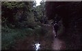
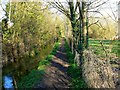
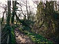
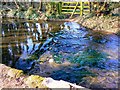

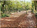
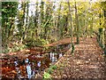
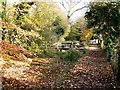
51 photos from this area
Area Information
Key information about the SN6 6QR including its size, population, and administrative classification.
- Area Type
- Postcode
- Area Size
- 1.2 km²
- Population
- 1778
- Population Density
- 87 people/km²
House Prices in SN6 6QR
26
Properties
£470,902
Average Sold Price
£230,000
Lowest Price
£934,927
Highest Price
Showing 26 properties
| Address | Type | Beds | Baths | Last Sale Price | Last Sale Date | |
|---|---|---|---|---|---|---|
| The Hidden Barn, North End, Ashton Keynes, SN6 6QR | house | 3 | 2 | £934,927 | Aug 2022 | |
| Home View, North End, Ashton Keynes, SN6 6QR | Bungalow | 3 | 2 | £380,000 | Sep 2021 | |
| The Old Dairy, North End, Ashton Keynes, SN6 6QR | Bungalow | 4 | 2 | £425,000 | Nov 2020 | |
| West Barn, North End, Ashton Keynes, SN6 6QR | house | - | - | £562,500 | Dec 2016 | |
| Ashcombe House, North End, Ashton Keynes, SN6 6QR | Semi-detached | 4 | 2 | £490,000 | Aug 2015 | |
| The Chaff Barn, North End, Ashton Keynes, SN6 6QR | Semi-detached | - | - | £230,000 | Apr 2008 | |
| Whitefriars, North End, Ashton Keynes, SN6 6QR | house | - | - | £620,000 | Jan 2004 | |
| Old Manor Farm, North End, Ashton Keynes, SN6 6QR | Bungalow | 4 | 2 | £498,000 | Dec 2001 | |
| Raglans, North End, Ashton Keynes, SN6 6QR | Bungalow | 4 | 2 | £249,500 | Nov 2000 | |
| East Barn, North End, Ashton Keynes, SN6 6QR | Semi-detached | - | - | £292,000 | Apr 2000 |
Page 1 of 3
Energy Efficiency in SN6 6QR
Amenities
Schools
| Rank | School | Type | Entry gender | Ages |
|---|
Explore more schools in this area
Go to Schools tabDemographics
Household Size
Two person
most common
Accommodation Type
Houses
most common
Tenure
84
majority
Ethnic Group
White
most common
Religion
N/A
most common
Household Composition
N/A
most common
Age
47
median
Adults (30-64 years)
most common
Household Deprivation
N/A
with no deprivation
NS-SEC
46
in Lower managerial occupations
Explore more demographic insights in this area
Go to Demographics tabPlanning
Planning Constraints
- Flood RiskPremium
- Ramsar Wetland SitesPremium
- Area of Outstanding Natural BeautyPremium
- Protected Nature ReservePremium
- Protected WoodlandPremium