Area Overview for GL7 6DF
Photos of GL7 6DF


Area Information
Living in GL7 6DF offers a quiet, residential experience in a small cluster of homes spread across 66.5 hectares. With a population of 1,532 people, the area maintains a low population density of 72 people per square kilometre, creating a relaxed, community-focused atmosphere. The demographic profile shows a mature population, with a median age of 47 and the majority of residents aged between 30 and 64. Over 80% of homes are owner-occupied, and the area is dominated by houses rather than flats, reflecting a stable, long-term residential base. Daily life is shaped by proximity to essential amenities. A primary school, Siddington Church of England Primary School, serves the area and holds a ‘good’ Ofsted rating, ensuring quality education for local children. Retail options include nearby Co-op, Lidl, and Tesco stores, while Kemble Railway Station provides links to regional transport networks. However, the area’s small size means residents must travel slightly further for secondary schools or larger retail hubs. A notable concern is the high flood risk, with 63.58% of the area falling within critical flood zones, which buyers should consider when planning for long-term living.
- Area Type
- Postcode
- Area Size
- 66.5 hectares
- Population
- 1532
- Population Density
- 72 people/km²
The property market in GL7 6DF is dominated by owner-occupied homes, with 82% of properties in private ownership. This high rate of home ownership suggests a stable, long-term residential base, with limited rental activity. The area is primarily composed of houses rather than flats, reflecting a preference for larger, more private living spaces. Given the small size of the area—just 66.5 hectares—the housing stock is likely limited, with few new developments. Buyers should expect a competitive market for existing properties, particularly if they align with the demand for family-friendly homes. The predominance of houses may appeal to those seeking space and privacy, though the lack of newer builds could mean older properties requiring renovation. The immediate surroundings may offer more options, but proximity to GL7 6DF’s amenities will be a key consideration for potential buyers.
House Prices in GL7 6DF
Showing 1 properties
| Address | Type | Beds | Baths | Last Sale Price | Last Sale Date | |
|---|---|---|---|---|---|---|
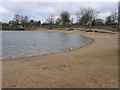
| Ash Covert Water Ski Club South East Of Keynes Park Windsurfing, Spratsgate Lane, Ashton Keynes, GL7 6DF | Leisure | - | - | - | - |
Energy Efficiency in GL7 6DF
Residents of GL7 6DF have access to a range of nearby amenities, including five retail outlets such as Co-op South, Lidl Cirencester, and Tesco Cirencester. These stores provide essential shopping options for groceries, household items, and everyday needs. The area’s proximity to Kemble Railway Station and Cotswold Airport enhances mobility, allowing easy travel to larger towns or for regional and international trips. While the data does not mention parks or leisure facilities, the presence of retail and transport options suggests a practical, service-oriented lifestyle. The small size of the area means residents may need to venture slightly further for specialist services or entertainment, but the availability of nearby shops and transport links ensures daily life remains convenient.
Amenities
Schools
The nearest school to GL7 6DF is Siddington Church of England Primary School, which serves the area and holds a ‘good’ Ofsted rating. This school caters to younger children, providing a foundation for primary education. However, the data does not mention secondary schools or further education institutions in the immediate vicinity, meaning families may need to travel to nearby towns for secondary schooling. The presence of a ‘good’-rated primary school is a positive factor for families, offering a reliable educational environment. The school’s location within practical reach of residents ensures ease of access for daily commutes. While the area’s small size limits the range of educational options, the quality of the primary school may offset this by attracting families prioritising early education.
| Rank | School | Type | Entry gender | Ages |
|---|
Explore more schools in this area
Go to Schools tabDemographics
The community in GL7 6DF is predominantly composed of adults aged 30 to 64, with a median age of 47. This suggests a mature, settled population, likely with established careers and families. Home ownership is high at 82%, indicating a strong presence of long-term residents rather than transient renters. The area is characterised by houses rather than flats, aligning with the demographic profile of older, family-oriented households. The predominant ethnic group is White, with no specific data provided on other ethnicities. The population density of 72 people per square kilometre means the area is neither densely packed nor isolated, offering a balance between privacy and access to local services. This density supports a close-knit community feel, where residents are likely to know their neighbours. The low proportion of younger or elderly residents may influence the social dynamics, with fewer schools or community centres catering to all age groups.
Household Size
Accommodation Type
Tenure
Ethnic Group
Religion
Household Composition
Age
Household Deprivation
NS-SEC
Explore more demographic insights in this area
Go to Demographics tabPlanning
Planning Constraints
- Flood RiskPremium
- Ramsar Wetland SitesPremium
- Area of Outstanding Natural BeautyPremium
- Protected Nature ReservePremium
- Protected WoodlandPremium