Area Overview for SN5 4EZ
Photos of SN5 4EZ
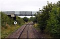
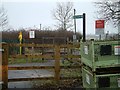
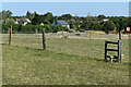
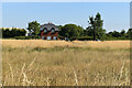
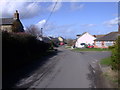
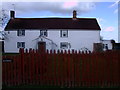
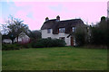
23 photos from this area
Area Information
Key information about the SN5 4EZ including its size, population, and administrative classification.
- Area Type
- Postcode
- Area Size
- 3.3 hectares
- Population
- 1623
- Population Density
- 168 people/km²
House Prices in SN5 4EZ
44
Properties
£228,406
Average Sold Price
£69,000
Lowest Price
£377,500
Highest Price
Showing 44 properties
| Address | Type | Beds | Baths | Last Sale Price | Last Sale Date | |
|---|---|---|---|---|---|---|
| 22 Vasterne Close, Purton, SN5 4EZ | Bungalow | 2 | 1 | £355,000 | Jul 2025 | |
| 56 Vasterne Close, Purton, SN5 4EZ | Detached | 3 | 2 | £248,000 | May 2025 | |
| 35 Vasterne Close, Purton, SN5 4EZ | Semi-detached | 3 | 2 | £377,500 | Apr 2024 | |
| 41 Vasterne Close, Purton, SN5 4EZ | Semi-detached | 4 | 1 | £370,000 | May 2023 | |
| 18 Vasterne Close, Purton, SN5 4EZ | Semi-detached | 3 | - | £305,900 | Mar 2022 | |
| 38 Vasterne Close, Purton, SN5 4EZ | Semi-detached | 3 | - | £260,000 | Sep 2018 | |
| 23 Vasterne Close, Purton, SN5 4EZ | Bungalow | 2 | 1 | £272,500 | Jul 2018 | |
| 46 Vasterne Close, Purton, SN5 4EZ | Semi-detached | 4 | 2 | £310,000 | May 2017 | |
| 34 Vasterne Close, Purton, SN5 4EZ | Semi-detached | 3 | - | £240,000 | Jul 2016 | |
| 24 Vasterne Close, Purton, SN5 4EZ | Bungalow | - | - | £215,000 | Nov 2012 |
Page 1 of 5
Energy Efficiency in SN5 4EZ
Amenities
Schools
| Rank | School | Type | Entry gender | Ages |
|---|
Explore more schools in this area
Go to Schools tabDemographics
Household Size
Two person
most common
Accommodation Type
Houses
most common
Tenure
83
majority
Ethnic Group
White
most common
Religion
N/A
most common
Household Composition
N/A
most common
Age
47
median
Adults (30-64 years)
most common
Household Deprivation
N/A
with no deprivation
NS-SEC
41
in Lower managerial occupations
Explore more demographic insights in this area
Go to Demographics tabPlanning
Planning Constraints
- Flood RiskPremium
- Ramsar Wetland SitesPremium
- Area of Outstanding Natural BeautyPremium
- Protected Nature ReservePremium
- Protected WoodlandPremium