Area Overview for SN15 4NB
Photos of SN15 4NB
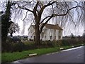
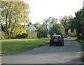
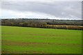
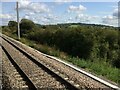
5 photos from this area
Area Information
Key information about the SN15 4NB including its size, population, and administrative classification.
- Area Type
- Postcode
- Area Size
- 36.0 hectares
- Population
- 1437
- Population Density
- 48 people/km²
House Prices in SN15 4NB
27
Properties
£405,000
Average Sold Price
£115,000
Lowest Price
£655,000
Highest Price
Showing 27 properties
| Address | Type | Beds | Baths | Last Sale Price | Last Sale Date | |
|---|---|---|---|---|---|---|
| West End Cottage, West End, Foxham, SN15 4NB | Detached | 3 | 1 | £655,000 | Jul 2019 | |
| Jenever House, West End, Foxham, SN15 4NB | Detached | 4 | 1 | £525,000 | Jan 2019 | |
| Reynards, West End, Foxham, SN15 4NB | house | - | - | £486,500 | Sep 2018 | |
| West End Stables, West End, Foxham, SN15 4NB | house | 5 | - | £540,000 | Mar 2013 | |
| The Paddocks, West End, Foxham, SN15 4NB | house | - | - | £485,000 | Jun 2011 | |
| Willowbrook House, West End, Foxham, SN15 4NB | Bungalow | - | - | £570,000 | Aug 2010 | |
| Briar House, West End, Foxham, SN15 4NB | house | - | - | £560,000 | Mar 2010 | |
| Springfield, West End, Foxham, SN15 4NB | Detached | - | - | £180,000 | Nov 2000 | |
| Laurieston, West End, Foxham, SN15 4NB | Detached | 5 | 2 | £365,000 | Feb 2000 | |
| Hughenden House, West End, Foxham, SN15 4NB | Bungalow | - | - | £220,000 | Dec 1998 |
Page 1 of 3
Energy Efficiency in SN15 4NB
Amenities
Schools
| Rank | School | Type | Entry gender | Ages |
|---|
Explore more schools in this area
Go to Schools tabDemographics
Household Size
Two person
most common
Accommodation Type
Houses
most common
Tenure
81
majority
Ethnic Group
White
most common
Religion
N/A
most common
Household Composition
N/A
most common
Age
47
median
Adults (30-64 years)
most common
Household Deprivation
N/A
with no deprivation
NS-SEC
46
in Lower managerial occupations
Explore more demographic insights in this area
Go to Demographics tabPlanning
Planning Constraints
- Flood RiskPremium
- Ramsar Wetland SitesPremium
- Area of Outstanding Natural BeautyPremium
- Protected Nature ReservePremium
- Protected WoodlandPremium