Area Overview for SN15 4LS
Photos of SN15 4LS
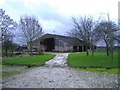
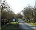
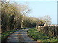
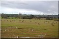

25 photos from this area
Area Information
Key information about the SN15 4LS including its size, population, and administrative classification.
- Area Type
- Postcode
- Area Size
- 2.1 km²
- Population
- 1500
- Population Density
- 55 people/km²
House Prices in SN15 4LS
15
Properties
£665,000
Average Sold Price
£510,000
Lowest Price
£875,000
Highest Price
Showing 15 properties
| Address | Type | Beds | Baths | Last Sale Price | Last Sale Date | |
|---|---|---|---|---|---|---|
| Rose Cottage, Avon, Avon, SN15 4LS | Detached | 4 | - | £610,000 | Sep 2019 | |
| Avon Wick, Maud Heaths Causeway North C 133 To Avon, Avon, SN15 4LS | Bungalow | - | - | £875,000 | Aug 2018 | |
| 1, Avon Farm Cottages, Avon, Avon, SN15 4LS | house | - | - | £510,000 | Jul 2017 | |
| Mobile Home, Carpenters Farm, Avon, Avon, SN15 4LS | Mobile Home | 5 | - | - | - | |
| Avon Farm, Avon, Avon, SN15 4LS | Detached | 3 | - | - | - | |
| Cobble Cottage, Maud Heaths Causeway North C 133 To Avon, Avon, SN15 4LS | house | - | - | - | - | |
| Manor Farm, Maud Heaths Causeway North C 133 To Avon, Avon, SN15 4LS | Detached | - | - | - | - | |
| Bridge Cottage, Maud Heaths Causeway North C 133 To Avon, Avon, SN15 4LS | Detached | - | - | - | - | |
| Partridge View, Maud Heaths Causeway North C 133 To Avon, Avon, SN15 4LS | Bungalow | - | - | - | - | |
| 2-3, Avon Farm Cottages, Avon, Avon, SN15 4LS | house | - | - | - | - |
Page 1 of 2
Energy Efficiency in SN15 4LS
Amenities
Schools
| Rank | School | Type | Entry gender | Ages |
|---|
Explore more schools in this area
Go to Schools tabDemographics
Household Size
Two person
most common
Accommodation Type
Houses
most common
Tenure
79
majority
Ethnic Group
White
most common
Religion
N/A
most common
Household Composition
N/A
most common
Age
47
median
Adults (30-64 years)
most common
Household Deprivation
N/A
with no deprivation
NS-SEC
44
in Lower managerial occupations
Explore more demographic insights in this area
Go to Demographics tabPlanning
Planning Constraints
- Flood RiskPremium
- Ramsar Wetland SitesPremium
- Area of Outstanding Natural BeautyPremium
- Protected Nature ReservePremium
- Protected WoodlandPremium