Area Overview for SN15 3RQ
Photos of SN15 3RQ
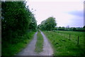
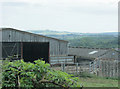
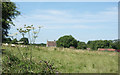
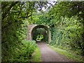
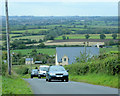
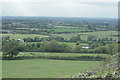
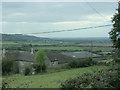

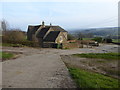
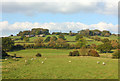
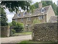
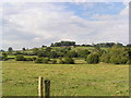
13 photos from this area
Area Information
Key information about the SN15 3RQ including its size, population, and administrative classification.
- Area Type
- Postcode
- Area Size
- 1.2 km²
- Population
- 1500
- Population Density
- 55 people/km²
House Prices in SN15 3RQ
16
Properties
£910,526
Average Sold Price
£367,630
Lowest Price
£1,700,000
Highest Price
Showing 16 properties
| Address | Type | Beds | Baths | Last Sale Price | Last Sale Date | |
|---|---|---|---|---|---|---|
| Stanley Bridge House, Bencroft Hill, Stanley, SN15 3RQ | Detached | 4 | 2 | £1,025,000 | Jun 2022 | |
| Bencroft House, Bencroft Hill, Stanley, SN15 3RQ | Detached | 4 | 2 | £1,700,000 | Apr 2022 | |
| Wharf Cottage, Bencroft Hill, Stanley, SN15 3RQ | Detached | 3 | 2 | £885,000 | Jun 2019 | |
| Beaconsfield, Bencroft Hill, Stanley, SN15 3RQ | Bungalow | 4 | 3 | £575,000 | Aug 2014 | |
| Holly House, Bencroft Hill, Stanley, SN15 3RQ | Semi-detached | - | - | £367,630 | Apr 2006 | |
| Bencroft Hill Farm Cottage, Bencroft Hill, Stanley, SN15 3RQ | Bungalow | 3 | - | - | - | |
| Bencroft Hill Farmhouse, Bencroft Hill, Stanley, SN15 3RQ | house | 4 | - | - | - | |
| Tennis 104M From Bencroft House, Bencroft Hill 120M From Unnamed Road, Bencroft Hill, Stanley, SN15 3RQ | Leisure | - | - | - | - | |
| The Granary Annexe, Wharf Cottage, Bencroft Hill, Stanley, SN15 3RQ | house | - | - | - | - | |
| Chapel Annexe, The Cottage, Bencroft Hill, Stanley, SN15 3RQ | Flat | - | - | - | - |
Page 1 of 2
Energy Efficiency in SN15 3RQ
Amenities
Schools
| Rank | School | Type | Entry gender | Ages |
|---|
Explore more schools in this area
Go to Schools tabDemographics
Household Size
Two person
most common
Accommodation Type
Houses
most common
Tenure
79
majority
Ethnic Group
White
most common
Religion
N/A
most common
Household Composition
N/A
most common
Age
47
median
Adults (30-64 years)
most common
Household Deprivation
N/A
with no deprivation
NS-SEC
44
in Lower managerial occupations
Explore more demographic insights in this area
Go to Demographics tabPlanning
Planning Constraints
- Flood RiskPremium
- Ramsar Wetland SitesPremium
- Area of Outstanding Natural BeautyPremium
- Protected Nature ReservePremium
- Protected WoodlandPremium