Area Overview for SN14 8EU
Photos of SN14 8EU
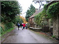
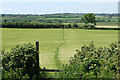
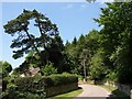
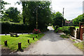
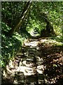
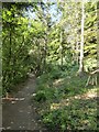
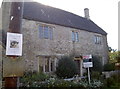
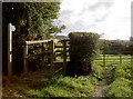
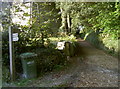
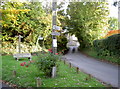
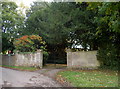
75 photos from this area
Area Information
Key information about the SN14 8EU including its size, population, and administrative classification.
- Area Type
- Postcode
- Area Size
- 4.5 hectares
- Population
- 1605
- Population Density
- 44 people/km²
House Prices in SN14 8EU
20
Properties
£432,167
Average Sold Price
£125,000
Lowest Price
£1,550,000
Highest Price
Showing 20 properties
| Address | Type | Beds | Baths | Last Sale Price | Last Sale Date | |
|---|---|---|---|---|---|---|
| The Old School House, Lower Street, Dyrham, SN14 8EU | Detached | 4 | 2 | £1,550,000 | Apr 2024 | |
| Holly Tree Cottage, 3 Lower Street, Dyrham, SN14 8EU | Semi-detached | 2 | - | £445,000 | Apr 2019 | |
| The Post Office Cottage, Lower Street, Dyrham, SN14 8EU | Semi-detached | - | - | £650,000 | Feb 2017 | |
| Rose Cottage, Lower Street, Dyrham, SN14 8EU | Semi-detached | 3 | - | £350,000 | Jan 2014 | |
| Lavender Cottage, Lower Street, Dyrham, SN14 8EU | Semi-detached | 3 | 2 | £435,000 | Nov 2013 | |
| Box Tree Cottage, Lower Street, Dyrham, SN14 8EU | Semi-detached | 3 | - | £460,000 | Jun 2013 | |
| Honeysuckle Cottage, Lower Street, Dyrham, SN14 8EU | Cottage | 3 | 1 | £275,000 | Mar 2013 | |
| Figtree Cottage, Lower Street, Dyrham, SN14 8EU | Semi-detached | 3 | 1 | £270,000 | Jun 2009 | |
| Daffodil Cottage, Lower Street, Dyrham, SN14 8EU | house | - | - | £285,000 | Jul 2006 | |
| Edwards Cottage, 9 Lower Street, Dyrham, SN14 8EU | house | 4 | 2 | £203,000 | Oct 1998 |
Page 1 of 2
Energy Efficiency in SN14 8EU
Amenities
Schools
| Rank | School | Type | Entry gender | Ages |
|---|
Explore more schools in this area
Go to Schools tabDemographics
Household Size
Two person
most common
Accommodation Type
Houses
most common
Tenure
80
majority
Ethnic Group
White
most common
Religion
N/A
most common
Household Composition
N/A
most common
Age
47
median
Adults (30-64 years)
most common
Household Deprivation
N/A
with no deprivation
NS-SEC
40
in Lower managerial occupations
Explore more demographic insights in this area
Go to Demographics tabPlanning
Planning Constraints
- Flood RiskPremium
- Ramsar Wetland SitesPremium
- Area of Outstanding Natural BeautyPremium
- Protected Nature ReservePremium
- Protected WoodlandPremium