Area Overview for SN11 8XR
Photos of SN11 8XR
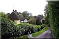
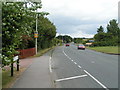

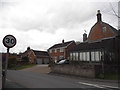
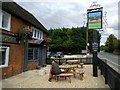
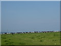
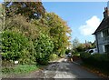
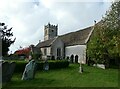
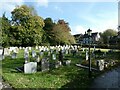
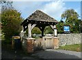
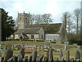
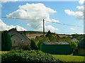
25 photos from this area
Area Information
Key information about the SN11 8XR including its size, population, and administrative classification.
- Area Type
- Postcode
- Area Size
- 11.4 hectares
- Population
- 1544
- Population Density
- 73 people/km²
House Prices in SN11 8XR
44
Properties
£445,718
Average Sold Price
£50,000
Lowest Price
£900,000
Highest Price
Showing 44 properties
| Address | Type | Beds | Baths | Last Sale Price | Last Sale Date | |
|---|---|---|---|---|---|---|
| 52 The Street, Cherhill, SN11 8XR | Bungalow | 3 | 1 | £514,000 | Aug 2025 | |
| 32 The Street, Cherhill, SN11 8XR | Detached | 3 | 1 | £524,000 | Feb 2025 | |
| Eulenhaus, 55 The Street, Cherhill, SN11 8XR | Detached | 5 | 2 | £515,000 | Mar 2024 | |
| 36 The Street, Cherhill, SN11 8XR | Detached | 4 | - | £575,000 | Aug 2023 | |
| 29 The Street, Cherhill, SN11 8XR | house | 4 | 3 | £875,000 | Jun 2023 | |
| 38 The Street, Cherhill, SN11 8XR | Detached | 4 | 2 | £650,000 | Jun 2023 | |
| 31 The Street, Cherhill, SN11 8XR | Detached | 5 | 5 | £900,000 | Mar 2022 | |
| 53 The Street, Cherhill, SN11 8XR | house | 5 | - | £640,000 | Jan 2022 | |
| 41 The Street, Cherhill, SN11 8XR | house | - | - | £472,381 | Jun 2021 | |
| House In Between, The Street, Cherhill, SN11 8XR | Detached | 4 | 2 | £475,000 | Jun 2021 |
Page 1 of 5
Energy Efficiency in SN11 8XR
Amenities
Schools
| Rank | School | Type | Entry gender | Ages |
|---|
Explore more schools in this area
Go to Schools tabDemographics
Household Size
Two person
most common
Accommodation Type
Houses
most common
Tenure
85
majority
Ethnic Group
White
most common
Religion
N/A
most common
Household Composition
N/A
most common
Age
47
median
Adults (30-64 years)
most common
Household Deprivation
N/A
with no deprivation
NS-SEC
42
in Lower managerial occupations
Explore more demographic insights in this area
Go to Demographics tabPlanning
Planning Constraints
- Flood RiskPremium
- Ramsar Wetland SitesPremium
- Area of Outstanding Natural BeautyPremium
- Protected Nature ReservePremium
- Protected WoodlandPremium