Area Overview for SN11 0PY
Photos of SN11 0PY
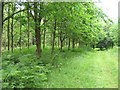

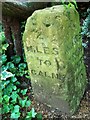
![Bowood House and gardens [76] in SN11 0PY](https://images.propbar.co.uk/images/geograph/70/50/7050994_120.jpg)
9 photos from this area
Area Information
Key information about the SN11 0PY including its size, population, and administrative classification.
- Area Type
- Postcode
- Area Size
- 81.3 hectares
- Population
- 2582
- Population Density
- 88 people/km²
House Prices in SN11 0PY
3
Properties
£1,049,000
Average Sold Price
£1,049,000
Lowest Price
£1,049,000
Highest Price
Showing 3 properties
| Address | Type | Beds | Baths | Last Sale Price | Last Sale Date | |
|---|---|---|---|---|---|---|
| Hollyditch Farm, Road From Tossels Farm North East To Silver Street Calne, Mile Elm, SN11 0PY | Detached | 6 | 2 | £1,049,000 | Jul 2020 | |
| Tossells Farm, Road From Tossels Farm North East To Silver Street Calne, Mile Elm, SN11 0PY | Detached | 6 | 3 | - | - | |
| The Barn, Road From Tossels Farm North East To Silver Street Calne, Mile Elm, SN11 0PY | Detached | - | - | - | - |
Energy Efficiency in SN11 0PY
Amenities
Schools
| Rank | School | Type | Entry gender | Ages |
|---|
Explore more schools in this area
Go to Schools tabDemographics
Household Size
Two person
most common
Accommodation Type
Houses
most common
Tenure
75
majority
Ethnic Group
White
most common
Religion
N/A
most common
Household Composition
N/A
most common
Age
47
median
Adults (30-64 years)
most common
Household Deprivation
N/A
with no deprivation
NS-SEC
43
in Lower managerial occupations
Explore more demographic insights in this area
Go to Demographics tabPlanning
Planning Constraints
- Flood RiskPremium
- Ramsar Wetland SitesPremium
- Area of Outstanding Natural BeautyPremium
- Protected Nature ReservePremium
- Protected WoodlandPremium