Area Overview for SN11 0PX
Photos of SN11 0PX
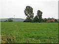
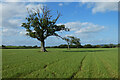
![The way to Quemerford [3] in SN11 0PX](https://images.propbar.co.uk/images/geograph/57/98/5798271_120.jpg)
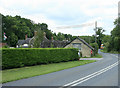
![Overgrown stile [1] in SN11 0PX](https://images.propbar.co.uk/images/geograph/57/98/5798272_120.jpg)
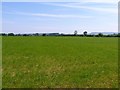
![Overgrown stile [2] in SN11 0PX](https://images.propbar.co.uk/images/geograph/57/98/5798274_120.jpg)
10 photos from this area
Area Information
Key information about the SN11 0PX including its size, population, and administrative classification.
- Area Type
- Postcode
- Area Size
- 22.7 hectares
- Population
- 2582
- Population Density
- 88 people/km²
House Prices in SN11 0PX
2
Properties
-
Average Sold Price
-
Lowest Price
-
Highest Price
Showing 2 properties
| Address | Type | Beds | Baths | Last Sale Price | Last Sale Date | |
|---|---|---|---|---|---|---|
| Maes Glas, 1 Road From Tossels Farm North East To Silver Street Calne, Mile Elm, SN11 0PX | Semi-detached | 4 | 2 | - | - | |
| Hillsview, Road From Tossels Farm North East To Silver Street Calne, Mile Elm, SN11 0PX | house | - | - | - | - |
Energy Efficiency in SN11 0PX
Amenities
Schools
| Rank | School | Type | Entry gender | Ages |
|---|
Explore more schools in this area
Go to Schools tabDemographics
Household Size
Two person
most common
Accommodation Type
Houses
most common
Tenure
75
majority
Ethnic Group
White
most common
Religion
N/A
most common
Household Composition
N/A
most common
Age
47
median
Adults (30-64 years)
most common
Household Deprivation
N/A
with no deprivation
NS-SEC
43
in Lower managerial occupations
Explore more demographic insights in this area
Go to Demographics tabPlanning
Planning Constraints
- Flood RiskPremium
- Ramsar Wetland SitesPremium
- Area of Outstanding Natural BeautyPremium
- Protected Nature ReservePremium
- Protected WoodlandPremium