Area Overview for SN10 3QS
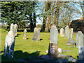
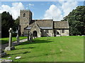
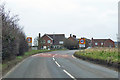
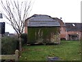
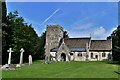
Photos of SN10 3QS
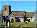
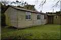
![Chirton buildings [1] in SN10 3QS](https://images.propbar.co.uk/images/geograph/74/58/7458220_120.jpg)
![Chirton buildings [3] in SN10 3QS](https://images.propbar.co.uk/images/geograph/74/59/7459280_120.jpg)
![Chirton buildings [4] in SN10 3QS](https://images.propbar.co.uk/images/geograph/74/59/7459282_120.jpg)
58 photos from this area
Area Information
Key information about the SN10 3QS including its size, population, and administrative classification.
- Area Type
- Postcode
- Area Size
- 17.6 hectares
- Population
- 1902
- Population Density
- 43 people/km²
House Prices in SN10 3QS
45
Properties
£441,300
Average Sold Price
£112,050
Lowest Price
£1,225,000
Highest Price
Showing 45 properties
| Address | Type | Beds | Baths | Last Sale Price | Last Sale Date | |
|---|---|---|---|---|---|---|
| Owls Barn, The Street, Chirton, SN10 3QS | Semi-detached | 2 | - | £550,000 | Oct 2023 | |
| 30 The Street, Chirton, SN10 3QS | Semi-detached | 3 | 1 | £350,000 | Sep 2023 | |
| Iris Cottage, 15 The Street, Chirton, SN10 3QS | Detached | 2 | 2 | £433,000 | Sep 2023 | |
| 20 The Street, Chirton, SN10 3QS | house | - | - | £475,000 | Mar 2021 | |
| Chirton Lodge, 63 The Street, Chirton, SN10 3QS | Detached | 3 | 1 | £575,000 | Nov 2020 | |
| 47 The Street, Chirton, SN10 3QS | house | - | - | £182,000 | Oct 2020 | |
| Tamarisk, 52 The Street, Chirton, SN10 3QS | house | - | - | £555,000 | Feb 2020 | |
| The Old Manor House, 61 The Street, Chirton, SN10 3QS | Detached | - | - | £1,225,000 | Nov 2017 | |
| 23 The Street, Chirton, SN10 3QS | house | - | - | £445,000 | Nov 2017 | |
| Glenthorne, 35 The Street, Chirton, SN10 3QS | Bungalow | - | - | £417,500 | Aug 2017 |
Page 1 of 5
Energy Efficiency in SN10 3QS
Amenities
Schools
| Rank | School | Type | Entry gender | Ages |
|---|
Explore more schools in this area
Go to Schools tabDemographics
Household Size
Two person
most common
Accommodation Type
Houses
most common
Tenure
77
majority
Ethnic Group
White
most common
Religion
N/A
most common
Household Composition
N/A
most common
Age
47
median
Adults (30-64 years)
most common
Household Deprivation
N/A
with no deprivation
NS-SEC
43
in Lower managerial occupations
Explore more demographic insights in this area
Go to Demographics tabPlanning
Planning Constraints
- Flood RiskPremium
- Ramsar Wetland SitesPremium
- Area of Outstanding Natural BeautyPremium
- Protected Nature ReservePremium
- Protected WoodlandPremium