Area Overview for SN10 3QN
Photos of SN10 3QN
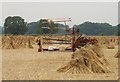
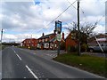
![Chirton features [2] in SN10 3QN](https://images.propbar.co.uk/images/geograph/74/60/7460813_120.jpg)
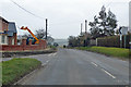
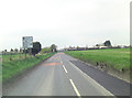
![Chirton buildings [5] in SN10 3QN](https://images.propbar.co.uk/images/geograph/74/60/7460819_120.jpg)
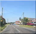
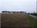
![Chirton features [1] in SN10 3QN](https://images.propbar.co.uk/images/geograph/74/60/7460811_120.jpg)
15 photos from this area
Area Information
Key information about the SN10 3QN including its size, population, and administrative classification.
- Area Type
- Postcode
- Area Size
- 1184 m²
- Population
- 1902
- Population Density
- 43 people/km²
House Prices in SN10 3QN
2
Properties
£670,000
Average Sold Price
£670,000
Lowest Price
£670,000
Highest Price
Showing 2 properties
| Address | Type | Beds | Baths | Last Sale Price | Last Sale Date | |
|---|---|---|---|---|---|---|
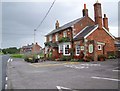
| The Old Pub, 9 Andover Road, Chirton, SN10 3QN | house | - | - | £670,000 | Oct 2019 | |
| Staff Accommodation, The Wiltshire Yeoman Inn, Andover Road, Chirton, SN10 3QN | Flat | - | - | - | - |
Energy Efficiency in SN10 3QN
Amenities
Schools
| Rank | School | Type | Entry gender | Ages |
|---|
Explore more schools in this area
Go to Schools tabDemographics
Household Size
Two person
most common
Accommodation Type
Houses
most common
Tenure
77
majority
Ethnic Group
White
most common
Religion
N/A
most common
Household Composition
N/A
most common
Age
47
median
Adults (30-64 years)
most common
Household Deprivation
N/A
with no deprivation
NS-SEC
43
in Lower managerial occupations
Explore more demographic insights in this area
Go to Demographics tabPlanning
Planning Constraints
- Flood RiskPremium
- Ramsar Wetland SitesPremium
- Area of Outstanding Natural BeautyPremium
- Protected Nature ReservePremium
- Protected WoodlandPremium