Area Overview for SN10 3FX
Photos of SN10 3FX
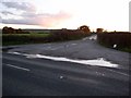
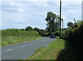
![Three ways to go [1] in SN10 3FX](https://images.propbar.co.uk/images/geograph/57/09/5709150_120.jpg)
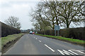
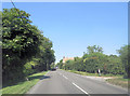
![Towards Marsh Farm [5] in SN10 3FX](https://images.propbar.co.uk/images/geograph/57/09/5709196_120.jpg)

24 photos from this area
Area Information
Key information about the SN10 3FX including its size, population, and administrative classification.
- Area Type
- Postcode
- Area Size
- 23.9 hectares
- Population
- 1939
- Population Density
- 54 people/km²
House Prices in SN10 3FX
1
Properties
-
Average Sold Price
-
Lowest Price
-
Highest Price
Showing 1 properties
| Address | Type | Beds | Baths | Last Sale Price | Last Sale Date | |
|---|---|---|---|---|---|---|
| Marsh Barns House, A 342 Etchilhampton Turning C 60 South East To Junction Past Bell Inn Lydeway, Lydeway, SN10 3FX | house | - | - | - | - |
Energy Efficiency in SN10 3FX
Amenities
Schools
| Rank | School | Type | Entry gender | Ages |
|---|
Explore more schools in this area
Go to Schools tabDemographics
Household Size
Two person
most common
Accommodation Type
Houses
most common
Tenure
78
majority
Ethnic Group
White
most common
Religion
N/A
most common
Household Composition
N/A
most common
Age
47
median
Adults (30-64 years)
most common
Household Deprivation
N/A
with no deprivation
NS-SEC
42
in Lower managerial occupations
Explore more demographic insights in this area
Go to Demographics tabPlanning
Planning Constraints
- Flood RiskPremium
- Ramsar Wetland SitesPremium
- Area of Outstanding Natural BeautyPremium
- Protected Nature ReservePremium
- Protected WoodlandPremium