Area Overview for SN10 4SB
Photos of SN10 4SB
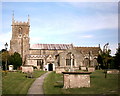
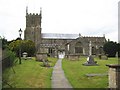
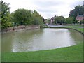
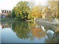
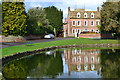
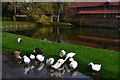
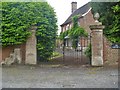

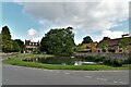
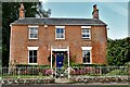
77 photos from this area
Area Information
Key information about the SN10 4SB including its size, population, and administrative classification.
- Area Type
- Postcode
- Area Size
- 40.4 hectares
- Population
- 1939
- Population Density
- 54 people/km²
House Prices in SN10 4SB
15
Properties
£521,857
Average Sold Price
£383,000
Lowest Price
£685,000
Highest Price
Showing 15 properties
| Address | Type | Beds | Baths | Last Sale Price | Last Sale Date | |
|---|---|---|---|---|---|---|
| Maydette, Uphill, Urchfont, SN10 4SB | house | - | - | £600,000 | Dec 2021 | |
| Uphill House, Uphill, Urchfont, SN10 4SB | Detached | 4 | 2 | £600,000 | Aug 2019 | |
| Oakdene, Uphill, Urchfont, SN10 4SB | Retail | 3 | 2 | £515,000 | Aug 2019 | |
| Fairview, Uphill, Urchfont, SN10 4SB | house | - | - | £685,000 | Jul 2019 | |
| Carina, Uphill, Urchfont, SN10 4SB | Detached | 3 | 2 | £475,000 | Jun 2011 | |
| Gaddon House, Uphill, Urchfont, SN10 4SB | house | 3 | - | £383,000 | Jul 2009 | |
| Uphill Cottage, Uphill, Urchfont, SN10 4SB | Detached | - | - | £395,000 | Jan 2000 | |
| The Rickyard, Uphill, Urchfont, SN10 4SB | house | - | - | - | - | |
| Franklins Farm, Uphill, Urchfont, SN10 4SB | Detached | - | - | - | - | |
| Jasmine Cottage, Uphill, Urchfont, SN10 4SB | house | - | - | - | - |
Page 1 of 2
Energy Efficiency in SN10 4SB
Amenities
Schools
| Rank | School | Type | Entry gender | Ages |
|---|
Explore more schools in this area
Go to Schools tabDemographics
Household Size
Two person
most common
Accommodation Type
Houses
most common
Tenure
78
majority
Ethnic Group
White
most common
Religion
N/A
most common
Household Composition
N/A
most common
Age
47
median
Adults (30-64 years)
most common
Household Deprivation
N/A
with no deprivation
NS-SEC
42
in Lower managerial occupations
Explore more demographic insights in this area
Go to Demographics tabPlanning
Planning Constraints
- Flood RiskPremium
- Ramsar Wetland SitesPremium
- Area of Outstanding Natural BeautyPremium
- Protected Nature ReservePremium
- Protected WoodlandPremium