Area Overview for SN10 2RZ
Photos of SN10 2RZ
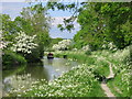
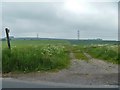
![Path to the bridge [2] in SN10 2RZ](https://images.propbar.co.uk/images/geograph/58/06/5806311_120.jpg)


41 photos from this area
Area Information
Key information about the SN10 2RZ including its size, population, and administrative classification.
- Area Type
- Postcode
- Area Size
- 42.2 hectares
- Population
- 1296
- Population Density
- 33 people/km²
House Prices in SN10 2RZ
51
Properties
£172,875
Average Sold Price
£154,500
Lowest Price
£200,000
Highest Price
Showing 51 properties
| Address | Type | Beds | Baths | Last Sale Price | Last Sale Date | |
|---|---|---|---|---|---|---|
| 42 Oak Close, Bishops Cannings, SN10 2RZ | Semi-detached | 2 | 1 | £200,000 | Oct 2020 | |
| 18 Oak Close, Bishops Cannings, SN10 2RZ | house | - | - | £180,000 | Jul 2012 | |
| 7 Oak Close, Bishops Cannings, SN10 2RZ | house | - | - | £154,500 | Apr 2005 | |
| 19 Oak Close, Bishops Cannings, SN10 2RZ | Semi-detached | - | - | £157,000 | Nov 2003 | |
| 34 Oak Close, Bishops Cannings, SN10 2RZ | house | - | - | - | - | |
| 8 Oak Close, Bishops Cannings, SN10 2RZ | house | - | - | - | - | |
| 27 Oak Close, Bishops Cannings, SN10 2RZ | house | - | - | - | - | |
| 40 Oak Close, Bishops Cannings, SN10 2RZ | house | - | - | - | - | |
| 44 Oak Close, Bishops Cannings, SN10 2RZ | house | - | - | - | - | |
| 25 Oak Close, Bishops Cannings, SN10 2RZ | house | - | - | - | - |
Page 1 of 6
Energy Efficiency in SN10 2RZ
Amenities
Schools
| Rank | School | Type | Entry gender | Ages |
|---|
Explore more schools in this area
Go to Schools tabDemographics
Household Size
Two person
most common
Accommodation Type
Houses
most common
Tenure
69
majority
Ethnic Group
White
most common
Religion
N/A
most common
Household Composition
N/A
most common
Age
47
median
Adults (30-64 years)
most common
Household Deprivation
N/A
with no deprivation
NS-SEC
40
in Lower managerial occupations
Explore more demographic insights in this area
Go to Demographics tabPlanning
Planning Constraints
- Flood RiskPremium
- Ramsar Wetland SitesPremium
- Area of Outstanding Natural BeautyPremium
- Protected Nature ReservePremium
- Protected WoodlandPremium