Area Overview for SN10 2JL
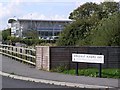
Photos of SN10 2JL
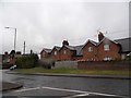
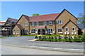
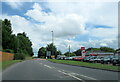
![Hopton Industrial Estate [5] in SN10 2JL](https://images.propbar.co.uk/images/geograph/42/45/4245589_120.jpg)
22 photos from this area
Area Information
Key information about the SN10 2JL including its size, population, and administrative classification.
- Area Type
- Postcode
- Area Size
- 32.2 hectares
- Population
- 1296
- Population Density
- 33 people/km²
House Prices in SN10 2JL
21
Properties
£233,243
Average Sold Price
£43,000
Lowest Price
£445,000
Highest Price
Showing 21 properties
| Address | Type | Beds | Baths | Last Sale Price | Last Sale Date | |
|---|---|---|---|---|---|---|
| 8 Wellington Drive, Devizes, SN10 2JL | Semi-detached | 3 | 1 | £445,000 | Mar 2021 | |
| 13 Wellington Drive, Devizes, SN10 2JL | house | - | - | £288,000 | Oct 2020 | |
| 1 Wellington Drive, Devizes, SN10 2JL | house | - | - | £295,000 | Sep 2020 | |
| 10 Wellington Drive, Devizes, SN10 2JL | Semi-detached | 3 | 1 | £290,000 | Dec 2019 | |
| Patch Cottage, 21 Wellington Drive, Devizes, SN10 2JL | house | - | - | £440,000 | Jul 2018 | |
| 12 Wellington Drive, Devizes, SN10 2JL | house | - | - | £330,000 | Apr 2018 | |
| 15 Wellington Drive, Devizes, SN10 2JL | house | - | - | £285,000 | Oct 2017 | |
| 4 Wellington Drive, Devizes, SN10 2JL | house | - | - | £192,000 | Jul 2011 | |
| 7 Wellington Drive, Devizes, SN10 2JL | Semi-detached | 3 | 1 | £175,000 | Mar 2010 | |
| 16 Wellington Drive, Devizes, SN10 2JL | house | - | - | £200,000 | Mar 2009 |
Page 1 of 3
Energy Efficiency in SN10 2JL
Amenities
Schools
| Rank | School | Type | Entry gender | Ages |
|---|
Explore more schools in this area
Go to Schools tabDemographics
Household Size
Two person
most common
Accommodation Type
Houses
most common
Tenure
69
majority
Ethnic Group
White
most common
Religion
N/A
most common
Household Composition
N/A
most common
Age
47
median
Adults (30-64 years)
most common
Household Deprivation
N/A
with no deprivation
NS-SEC
40
in Lower managerial occupations
Explore more demographic insights in this area
Go to Demographics tabPlanning
Planning Constraints
- Flood RiskPremium
- Ramsar Wetland SitesPremium
- Area of Outstanding Natural BeautyPremium
- Protected Nature ReservePremium
- Protected WoodlandPremium