Area Overview for SN1 2DY
Photos of SN1 2DY
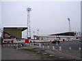
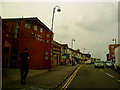
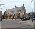
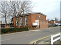

100 photos from this area
Area Information
Key information about the SN1 2DY including its size, population, and administrative classification.
- Area Type
- Postcode
- Area Size
- 1.1 hectares
- Population
- 2472
- Population Density
- 12226 people/km²
House Prices in SN1 2DY
66
Properties
£223,962
Average Sold Price
£133,000
Lowest Price
£325,000
Highest Price
Showing 66 properties
| Address | Type | Beds | Baths | Last Sale Price | Last Sale Date | |
|---|---|---|---|---|---|---|
| 126 County Road, Swindon, SN1 2DY | Terraced | 5 | 2 | £290,000 | Jul 2023 | |
| 178 County Road, Swindon, SN1 2DY | house | 1 | 1 | £285,000 | May 2023 | |
| 194 County Road, Swindon, SN1 2DY | house | - | - | £325,000 | Dec 2022 | |
| 144 County Road, Swindon, SN1 2DY | house | 3 | 1 | £255,000 | Aug 2022 | |
| 172 County Road, Swindon, SN1 2DY | house | - | - | £213,000 | May 2020 | |
| 150 County Road, Swindon, SN1 2DY | Terraced | 1 | 6 | £261,000 | May 2020 | |
| 148 County Road, Swindon, SN1 2DY | house | - | - | £245,000 | Jun 2017 | |
| 166 County Road, Swindon, SN1 2DY | Terraced | 4 | 1 | £240,000 | Sep 2016 | |
| 140 County Road, Swindon, SN1 2DY | house | 13 | 13 | £190,000 | Mar 2015 | |
| 138 County Road, Swindon, SN1 2DY | house | - | - | £158,000 | Mar 2015 |
Page 1 of 7
Energy Efficiency in SN1 2DY
Amenities
Schools
| Rank | School | Type | Entry gender | Ages |
|---|
Explore more schools in this area
Go to Schools tabDemographics
Household Size
Family (3-5 people)
most common
Accommodation Type
Houses
most common
Tenure
53
majority
Ethnic Group
asian_total
most common
Religion
N/A
most common
Household Composition
N/A
most common
Age
47
median
Adults (30-64 years)
most common
Household Deprivation
N/A
with no deprivation
NS-SEC
11
in Lower managerial occupations
Explore more demographic insights in this area
Go to Demographics tabPlanning
Planning Constraints
- Flood RiskPremium
- Ramsar Wetland SitesPremium
- Area of Outstanding Natural BeautyPremium
- Protected Nature ReservePremium
- Protected WoodlandPremium