Area Overview for PL9 9HF
Photos of PL9 9HF
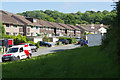
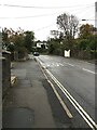
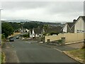
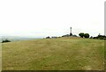
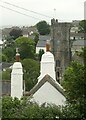
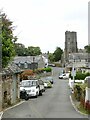
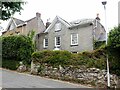
29 photos from this area
Area Information
Key information about the PL9 9HF including its size, population, and administrative classification.
- Area Type
- Postcode
- Area Size
- 7129 m²
- Population
- 1434
- Population Density
- 3422 people/km²
House Prices in PL9 9HF
16
Properties
£152,080
Average Sold Price
£41,500
Lowest Price
£330,000
Highest Price
Showing 16 properties
| Address | Type | Beds | Baths | Last Sale Price | Last Sale Date | |
|---|---|---|---|---|---|---|
| 15 Morrish Park, Plymouth, PL9 9HF | Bungalow | 4 | 2 | £330,000 | Dec 2025 | |
| 29 Morrish Park, Plymouth, PL9 9HF | Flat | - | - | £165,000 | Apr 2023 | |
| 25 Morrish Park, Plymouth, PL9 9HF | Flat | - | - | £136,250 | Mar 2022 | |
| 17 Morrish Park, Plymouth, PL9 9HF | Flat | - | - | £142,000 | Apr 2021 | |
| 3 Morrish Park, Plymouth, PL9 9HF | Bungalow | 3 | - | £295,000 | Jul 2018 | |
| 27 Morrish Park, Plymouth, PL9 9HF | Flat | 2 | 1 | £95,000 | Dec 2011 | |
| 11 Morrish Park, Plymouth, PL9 9HF | Bungalow | - | - | £190,000 | May 2010 | |
| 33 Morrish Park, Plymouth, PL9 9HF | Detached | - | - | £223,000 | Mar 2006 | |
| 35 Morrish Park, Plymouth, PL9 9HF | Detached | - | - | £236,500 | Mar 2005 | |
| 7 Morrish Park, Plymouth, PL9 9HF | Bungalow | - | - | £155,000 | Jul 2003 |
Page 1 of 2
Energy Efficiency in PL9 9HF
Amenities
Schools
| Rank | School | Type | Entry gender | Ages |
|---|
Explore more schools in this area
Go to Schools tabDemographics
Household Size
Two person
most common
Accommodation Type
Houses
most common
Tenure
76
majority
Ethnic Group
White
most common
Religion
N/A
most common
Household Composition
N/A
most common
Age
47
median
Adults (30-64 years)
most common
Household Deprivation
N/A
with no deprivation
NS-SEC
37
in Lower managerial occupations
Explore more demographic insights in this area
Go to Demographics tabPlanning
Planning Constraints
- Flood RiskPremium
- Ramsar Wetland SitesPremium
- Area of Outstanding Natural BeautyPremium
- Protected Nature ReservePremium
- Protected WoodlandPremium