Area Overview for PL9 7QE
Photos of PL9 7QE
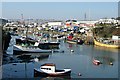
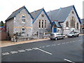
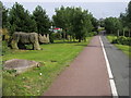
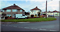
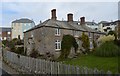
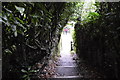
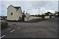
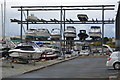

98 photos from this area
Area Information
Key information about the PL9 7QE including its size, population, and administrative classification.
- Area Type
- Postcode
- Area Size
- 4467 m²
- Population
- 1779
- Population Density
- 3595 people/km²
House Prices in PL9 7QE
11
Properties
£125,975
Average Sold Price
£66,950
Lowest Price
£185,000
Highest Price
Showing 11 properties
| Address | Type | Beds | Baths | Last Sale Price | Last Sale Date | |
|---|---|---|---|---|---|---|
| Trenarren, Broad Park, Plymouth, PL9 7QE | Bungalow | 2 | - | £185,000 | Oct 2012 | |
| Rosswey, Broad Park, Plymouth, PL9 7QE | Semi-detached | - | - | £66,950 | Jan 1998 | |
| Lyndens, Broad Park, Plymouth, PL9 7QE | Bungalow | - | - | - | - | |
| (former) The Homestead, Broad Park, Plymouth, PL9 7QE | Detached | - | - | - | - | |
| Broadhurst, Broad Park, Plymouth, PL9 7QE | Detached | - | - | - | - | |
| Bella Vista, Broad Park, Plymouth, PL9 7QE | Detached | - | - | - | - | |
| Roundsnest, Broad Park, Plymouth, PL9 7QE | Detached | - | - | - | - | |
| Sunset, Broad Park, Plymouth, PL9 7QE | Bungalow | - | - | - | - | |
| 8 Broad Park, Plymouth, PL9 7QE | Semi-detached | - | - | - | - | |
| Grenfell, Broad Park, Plymouth, PL9 7QE | Detached | - | - | - | - |
Page 1 of 2
Energy Efficiency in PL9 7QE
Amenities
Schools
| Rank | School | Type | Entry gender | Ages |
|---|
Explore more schools in this area
Go to Schools tabDemographics
Household Size
Two person
most common
Accommodation Type
Houses
most common
Tenure
79
majority
Ethnic Group
White
most common
Religion
N/A
most common
Household Composition
N/A
most common
Age
47
median
Adults (30-64 years)
most common
Household Deprivation
N/A
with no deprivation
NS-SEC
38
in Lower managerial occupations
Explore more demographic insights in this area
Go to Demographics tabPlanning
Planning Constraints
- Flood RiskPremium
- Ramsar Wetland SitesPremium
- Area of Outstanding Natural BeautyPremium
- Protected Nature ReservePremium
- Protected WoodlandPremium