Area Overview for PL9 7QB
Photos of PL9 7QB
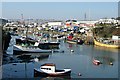
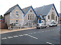
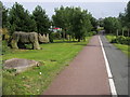
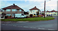
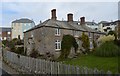
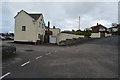
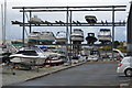
98 photos from this area
Area Information
Key information about the PL9 7QB including its size, population, and administrative classification.
- Area Type
- Postcode
- Area Size
- 2364 m²
- Population
- 1779
- Population Density
- 3595 people/km²
House Prices in PL9 7QB
7
Properties
£191,250
Average Sold Price
£49,500
Lowest Price
£328,000
Highest Price
Showing 7 properties
| Address | Type | Beds | Baths | Last Sale Price | Last Sale Date | |
|---|---|---|---|---|---|---|
| 138 Plymstock Road, Plymouth, PL9 7QB | Bungalow | - | - | £270,000 | Jan 2022 | |
| 148 Plymstock Road, Plymouth, PL9 7QB | house | - | - | £180,000 | May 2021 | |
| 140 Plymstock Road, Plymouth, PL9 7QB | Detached | 3 | 1 | £328,000 | Nov 2017 | |
| 144 Plymstock Road, Plymouth, PL9 7QB | house | 3 | - | £237,000 | Aug 2013 | |
| 150 Plymstock Road, Plymouth, PL9 7QB | Cottage | 2 | - | £83,000 | Feb 2009 | |
| 146 Plymstock Road, Plymouth, PL9 7QB | Semi-detached | - | - | £49,500 | Sep 1996 | |
| 142 Plymstock Road, Plymouth, PL9 7QB | Terraced | - | - | - | - |
Energy Efficiency in PL9 7QB
Amenities
Schools
| Rank | School | Type | Entry gender | Ages |
|---|
Explore more schools in this area
Go to Schools tabDemographics
Household Size
Two person
most common
Accommodation Type
Houses
most common
Tenure
79
majority
Ethnic Group
White
most common
Religion
N/A
most common
Household Composition
N/A
most common
Age
47
median
Adults (30-64 years)
most common
Household Deprivation
N/A
with no deprivation
NS-SEC
38
in Lower managerial occupations
Explore more demographic insights in this area
Go to Demographics tabPlanning
Planning Constraints
- Flood RiskPremium
- Ramsar Wetland SitesPremium
- Area of Outstanding Natural BeautyPremium
- Protected Nature ReservePremium
- Protected WoodlandPremium