Area Overview for PL7 4EJ
Photos of PL7 4EJ


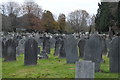
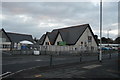
54 photos from this area
Area Information
Key information about the PL7 4EJ including its size, population, and administrative classification.
- Area Type
- Postcode
- Area Size
- 8896 m²
- Population
- 1645
- Population Density
- 3197 people/km²
House Prices in PL7 4EJ
23
Properties
£153,581
Average Sold Price
£44,500
Lowest Price
£270,000
Highest Price
Showing 23 properties
| Address | Type | Beds | Baths | Last Sale Price | Last Sale Date | |
|---|---|---|---|---|---|---|
| 26 Revell Park Road, Plymouth, PL7 4EJ | Semi-detached | 2 | 1 | £230,000 | Mar 2024 | |
| 18 Revell Park Road, Plymouth, PL7 4EJ | Semi-detached | 2 | 1 | £270,000 | Jan 2024 | |
| 23 Revell Park Road, Plymouth, PL7 4EJ | Semi-detached | 3 | 1 | £270,000 | Mar 2022 | |
| 20 Revell Park Road, Plymouth, PL7 4EJ | Bungalow | 2 | 1 | £195,000 | Jan 2021 | |
| 42 Revell Park Road, Plymouth, PL7 4EJ | Semi-detached | 3 | 2 | £218,000 | May 2020 | |
| 22 Revell Park Road, Plymouth, PL7 4EJ | Semi-detached | 2 | 1 | £220,000 | Feb 2018 | |
| 28 Revell Park Road, Plymouth, PL7 4EJ | Semi-detached | 2 | 1 | £175,000 | Jul 2017 | |
| 25 Revell Park Road, Plymouth, PL7 4EJ | Semi-detached | 2 | - | £169,000 | Sep 2013 | |
| 29 Revell Park Road, Plymouth, PL7 4EJ | Semi-detached | 2 | 1 | £170,000 | Apr 2013 | |
| 34 Revell Park Road, Plymouth, PL7 4EJ | Bungalow | 2 | - | £161,000 | Aug 2012 |
Page 1 of 3
Energy Efficiency in PL7 4EJ
Amenities
Schools
| Rank | School | Type | Entry gender | Ages |
|---|
Explore more schools in this area
Go to Schools tabDemographics
Household Size
Two person
most common
Accommodation Type
Houses
most common
Tenure
75
majority
Ethnic Group
White
most common
Religion
N/A
most common
Household Composition
N/A
most common
Age
47
median
Elderly (65+ years)
most common
Household Deprivation
N/A
with no deprivation
NS-SEC
31
in Lower managerial occupations
Explore more demographic insights in this area
Go to Demographics tabPlanning
Planning Constraints
- Flood RiskPremium
- Ramsar Wetland SitesPremium
- Area of Outstanding Natural BeautyPremium
- Protected Nature ReservePremium
- Protected WoodlandPremium