Area Overview for PL5 3EB
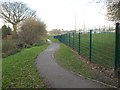
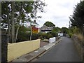
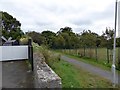
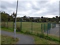
Photos of PL5 3EB


Area Information
Living in PL5 3EB means settling into a tightly defined residential cluster of just 8,716 square metres. This small postcode serves 1,377 residents, creating an intimate setting where neighbours are inevitably within sight. The area sits firmly within Devon, England, punching above its weight with a population density of 157,977 people per square kilometre. Such a high concentration of households in a limited footprint indicates a purpose-built estate or a very dense urban pocket rather than scattered suburban sprawl. You are joining a community where daily rhythms are defined by proximity. The environment is not one of rolling countryside, but of concentrated living. This specific site offers a distinct lifestyle for those who prefer walking distances to amenities over long commutes in traffic. The limited land size suggests a finished development or a tightly managed housing zone. Residents here share immediate access to the facilities located nearby without the need for extensive travel. This density often brings convenience at the cost of the traditional large-garden feel found in less crowded postcodes. The character of PL5 3EB is defined by these boundaries, which shape how you experience the surrounding city of Plymouth.
- Area Type
- Postcode
- Area Size
- 8716 m²
- Population
- 1377
- Population Density
- 4340 people/km²
The property market in PL5 3EB centres on houses, which serve as the dominant accommodation type. A 44% home ownership rate indicates that nearly half of the households have purchased their dwellings, while the other half rents. This split creates a balanced market where both buyers and tenants are active participants in the local economy. Because the postcode covers such a small physical area of 8,716 square metres, the total housing stock is finite. You should view properties in this cluster with the understanding that stock turnover may be slower due to the limited number of units available. The presence of house owners alongside tenants suggests a mix of permanent families and longer-term renters rather than a volatile student generation. When looking for homes in this area, you will find a traditional residential product rather than purpose-built flats or detached luxury estates. The market reflects the needs of the adult population aged 30 to 64. Prices here will reflect the value of secure tenure for owners and reliable rents for tenants. This is a pragmatic part of the broader Plymouth market where practicality outweighs the luxury of seclusion or excess space.
House Prices in PL5 3EB
Showing 34 properties
| Address | Type | Beds | Baths | Last Sale Price | Last Sale Date | |
|---|---|---|---|---|---|---|
| 97 Ruskin Crescent, Plymouth, PL5 3EB | Terraced | 3 | 2 | £180,000 | Oct 2025 | |
| 89 Ruskin Crescent, Plymouth, PL5 3EB | Terraced | 2 | 1 | £186,000 | Jun 2025 | |
| 125 Ruskin Crescent, Plymouth, PL5 3EB | Terraced | 2 | 1 | £175,000 | Mar 2024 | |
| 129 Ruskin Crescent, Plymouth, PL5 3EB | Semi-detached | 3 | 1 | £212,500 | Feb 2024 | |
| 111 Ruskin Crescent, Plymouth, PL5 3EB | Terraced | 3 | 1 | £219,000 | Feb 2023 | |
| 73 Ruskin Crescent, Plymouth, PL5 3EB | house | 3 | 1 | £185,500 | Sep 2022 | |
| 139 Ruskin Crescent, Plymouth, PL5 3EB | Terraced | 3 | 1 | £156,000 | Oct 2019 | |
| 127 Ruskin Crescent, Plymouth, PL5 3EB | Terraced | 3 | - | £127,000 | May 2018 | |
| 93 Ruskin Crescent, Plymouth, PL5 3EB | Terraced | 3 | 1 | £120,000 | Apr 2017 | |
| 113 Ruskin Crescent, Plymouth, PL5 3EB | Terraced | 3 | - | £138,000 | Apr 2014 |
Energy Efficiency in PL5 3EB
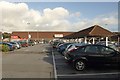
Your daily life in PL5 3EB extends beyond the small postcode boundaries to the wider area of Honicknowle and Plymouth. Within practical reach are five retail outlets, including Tesco Plymouth, Lidl Honicknowle, and Farmfoods Honicknowle, ensuring your grocery and shopping needs are met without a long journey. There are no pubs listed as immediate amenities in this specific dataset, but the proximity to major supermarkets provides excellent convenience. Connectivity to the wider region is robust, with five railway stations available, including St Budeaux Ferry Road, St Budeaux Victoria Road, and Keyham, all relatively close by. Two airports, specifically Plymouth City Airport, serve the local area. Additionally, five ferry terminals, such as the Devonport Ferry Terminal and Plymouth Landing Stage, offer easy links to surrounding counties if you travel by boat. This infrastructure makes PL5 3EB a functionally connected part of the wider Plymouth network. You have access to major transport hubs while living in a dense, convenient residential setting.
Amenities
Schools
| Rank | School | Type | Entry gender | Ages |
|---|
Explore more schools in this area
Go to Schools tabDemographics
The community in PL5 3EB is dominated by adults aged between 30 and 64 years. This age group forms the most common demographic, suggesting a household base of working professionals or established families rather than young apprentices or elderly retirees. The median age is 47, which aligns with a mature cohort that likely owns their properties outright or follows a steady mortgage trajectory. Home ownership stands at 44% of all residents, a figure slightly below the national average for single postcodes, implying a significant number of renters alongside owners. Houses remain the primary accommodation type within this specific zone. White residents form the predominant ethnic group in the area. Deprivation levels are not explicitly listed in the provided statistics, so a direct assessment of economic hardship cannot be made from these figures alone. However, the age profile suggests a stable population rather than one undergoing rapid, temporary displacement. The housing stock is geared towards standard family living rather than luxury development or transient student quarters. This demographic makeup creates a neighbourly environment where long-term residents are likely to know one another well.
Household Size
Accommodation Type
Tenure
Ethnic Group
Religion
Household Composition
Age
Household Deprivation
NS-SEC
Explore more demographic insights in this area
Go to Demographics tabPlanning
Planning Constraints
- Flood RiskPremium
- Ramsar Wetland SitesPremium
- Area of Outstanding Natural BeautyPremium
- Protected Nature ReservePremium
- Protected WoodlandPremium