Area Overview for PL3 6HE
Photos of PL3 6HE
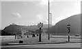

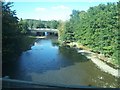
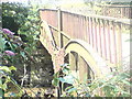

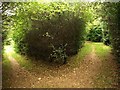

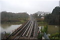


100 photos from this area
Area Information
Key information about the PL3 6HE including its size, population, and administrative classification.
- Area Type
- Postcode
- Area Size
- 1.7 hectares
- Population
- 1451
- Population Density
- 2108 people/km²
House Prices in PL3 6HE
44
Properties
£149,426
Average Sold Price
£39,950
Lowest Price
£245,000
Highest Price
Showing 44 properties
| Address | Type | Beds | Baths | Last Sale Price | Last Sale Date | |
|---|---|---|---|---|---|---|
| 89 Thames Gardens, Plymouth, PL3 6HE | house | 3 | 1 | £245,000 | Sep 2025 | |
| 63 Thames Gardens, Plymouth, PL3 6HE | Detached | 3 | 1 | £175,000 | Aug 2025 | |
| 52 Thames Gardens, Plymouth, PL3 6HE | Semi-detached | 3 | 1 | £225,000 | May 2025 | |
| 107 Thames Gardens, Plymouth, PL3 6HE | Terraced | 3 | 1 | £215,000 | May 2025 | |
| 73 Thames Gardens, Plymouth, PL3 6HE | Detached | 3 | 1 | £225,000 | May 2024 | |
| 101 Thames Gardens, Plymouth, PL3 6HE | Semi-detached | 3 | 1 | £210,000 | Nov 2023 | |
| 82 Thames Gardens, Plymouth, PL3 6HE | Semi-detached | 3 | 1 | £236,000 | Oct 2023 | |
| 81 Thames Gardens, Plymouth, PL3 6HE | house | - | - | £150,000 | Nov 2021 | |
| 97 Thames Gardens, Plymouth, PL3 6HE | house | - | - | £172,500 | Sep 2021 | |
| 111 Thames Gardens, Plymouth, PL3 6HE | house | - | - | £126,000 | Jul 2018 |
Page 1 of 5
Energy Efficiency in PL3 6HE
Amenities
Schools
| Rank | School | Type | Entry gender | Ages |
|---|
Explore more schools in this area
Go to Schools tabDemographics
Household Size
Family (3-5 people)
most common
Accommodation Type
Houses
most common
Tenure
53
majority
Ethnic Group
White
most common
Religion
N/A
most common
Household Composition
N/A
most common
Age
47
median
Adults (30-64 years)
most common
Household Deprivation
N/A
with no deprivation
NS-SEC
18
in Lower managerial occupations
Explore more demographic insights in this area
Go to Demographics tabPlanning
Planning Constraints
- Flood RiskPremium
- Ramsar Wetland SitesPremium
- Area of Outstanding Natural BeautyPremium
- Protected Nature ReservePremium
- Protected WoodlandPremium