Area Overview for PL3 6HA
Photos of PL3 6HA
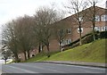
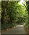
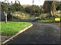
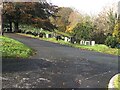


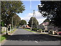
18 photos from this area
Area Information
Key information about the PL3 6HA including its size, population, and administrative classification.
- Area Type
- Postcode
- Area Size
- 1.7 hectares
- Population
- 1451
- Population Density
- 2108 people/km²
House Prices in PL3 6HA
62
Properties
£116,435
Average Sold Price
£47,500
Lowest Price
£185,000
Highest Price
Showing 62 properties
| Address | Type | Beds | Baths | Last Sale Price | Last Sale Date | |
|---|---|---|---|---|---|---|
| 52 Stott Close, Plymouth, PL3 6HA | house | - | - | £179,000 | May 2022 | |
| 60 Stott Close, Plymouth, PL3 6HA | Semi-detached | 3 | - | £185,000 | Mar 2021 | |
| 45 Stott Close, Plymouth, PL3 6HA | Semi-detached | 2 | 1 | £144,200 | May 2019 | |
| 61 Stott Close, Plymouth, PL3 6HA | Semi-detached | 3 | - | £160,000 | Jun 2015 | |
| 48 Stott Close, Plymouth, PL3 6HA | house | - | - | £87,500 | Aug 2013 | |
| 53 Stott Close, Plymouth, PL3 6HA | house | - | - | £109,000 | Nov 2012 | |
| 46 Stott Close, Plymouth, PL3 6HA | house | 2 | - | £92,000 | Jul 2011 | |
| 49 Stott Close, Plymouth, PL3 6HA | house | 3 | - | £120,000 | Jun 2005 | |
| 47 Stott Close, Plymouth, PL3 6HA | Terraced | 2 | 1 | £102,500 | Oct 2004 | |
| 54 Stott Close, Plymouth, PL3 6HA | Terraced | - | - | £83,950 | Jan 2003 |
Page 1 of 7
Energy Efficiency in PL3 6HA
Amenities
Schools
| Rank | School | Type | Entry gender | Ages |
|---|
Explore more schools in this area
Go to Schools tabDemographics
Household Size
Family (3-5 people)
most common
Accommodation Type
Houses
most common
Tenure
53
majority
Ethnic Group
White
most common
Religion
N/A
most common
Household Composition
N/A
most common
Age
47
median
Adults (30-64 years)
most common
Household Deprivation
N/A
with no deprivation
NS-SEC
18
in Lower managerial occupations
Explore more demographic insights in this area
Go to Demographics tabPlanning
Planning Constraints
- Flood RiskPremium
- Ramsar Wetland SitesPremium
- Area of Outstanding Natural BeautyPremium
- Protected Nature ReservePremium
- Protected WoodlandPremium