Area Overview for PL3 5DS
Photos of PL3 5DS
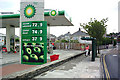

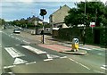
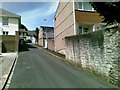
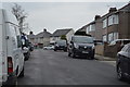
24 photos from this area
Area Information
Key information about the PL3 5DS including its size, population, and administrative classification.
- Area Type
- Postcode
- Area Size
- 6632 m²
- Population
- 1721
- Population Density
- 4575 people/km²
House Prices in PL3 5DS
33
Properties
£168,008
Average Sold Price
£47,500
Lowest Price
£280,000
Highest Price
Showing 33 properties
| Address | Type | Beds | Baths | Last Sale Price | Last Sale Date | |
|---|---|---|---|---|---|---|
| 65 Blandford Road, Plymouth, PL3 5DS | Retail | 3 | 1 | £257,000 | Sep 2022 | |
| 19 Blandford Road, Plymouth, PL3 5DS | Terraced | 3 | 1 | £280,000 | Mar 2022 | |
| 3 Blandford Road, Plymouth, PL3 5DS | Terraced | 3 | 1 | £230,000 | Feb 2022 | |
| 55 Blandford Road, Plymouth, PL3 5DS | house | - | - | £247,000 | Jan 2022 | |
| 61 Blandford Road, Plymouth, PL3 5DS | Terraced | 3 | 1 | £202,000 | Mar 2021 | |
| 41 Blandford Road, Plymouth, PL3 5DS | Terraced | 3 | 1 | £212,500 | Jul 2020 | |
| 45 Blandford Road, Plymouth, PL3 5DS | Terraced | 4 | 2 | £175,000 | Mar 2020 | |
| 57 Blandford Road, Plymouth, PL3 5DS | Terraced | - | - | £115,000 | Jul 2018 | |
| 13 Blandford Road, Plymouth, PL3 5DS | Terraced | 3 | 1 | £170,000 | Apr 2017 | |
| 11 Blandford Road, Plymouth, PL3 5DS | Terraced | 4 | 1 | £168,000 | Mar 2014 |
Page 1 of 4
Energy Efficiency in PL3 5DS
Amenities
Schools
| Rank | School | Type | Entry gender | Ages |
|---|
Explore more schools in this area
Go to Schools tabDemographics
Household Size
Two person
most common
Accommodation Type
Houses
most common
Tenure
81
majority
Ethnic Group
White
most common
Religion
N/A
most common
Household Composition
N/A
most common
Age
47
median
Adults (30-64 years)
most common
Household Deprivation
N/A
with no deprivation
NS-SEC
38
in Lower managerial occupations
Explore more demographic insights in this area
Go to Demographics tabPlanning
Planning Constraints
- Flood RiskPremium
- Ramsar Wetland SitesPremium
- Area of Outstanding Natural BeautyPremium
- Protected Nature ReservePremium
- Protected WoodlandPremium