Area Overview for PL3 5ER
Photos of PL3 5ER
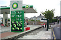
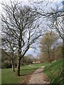
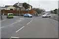
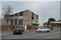
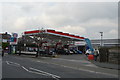
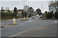

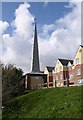
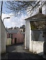
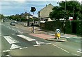
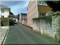
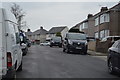
24 photos from this area
Area Information
Key information about the PL3 5ER including its size, population, and administrative classification.
- Area Type
- Postcode
- Area Size
- 7381 m²
- Population
- 1721
- Population Density
- 4575 people/km²
House Prices in PL3 5ER
25
Properties
£145,550
Average Sold Price
£63,000
Lowest Price
£470,000
Highest Price
Showing 25 properties
| Address | Type | Beds | Baths | Last Sale Price | Last Sale Date | |
|---|---|---|---|---|---|---|
| 54 Priory Road, Plymouth, PL3 5ER | Detached | 3 | 1 | £245,000 | Jan 2025 | |
| 81 Priory Road, Plymouth, PL3 5ER | Cottage | 3 | 1 | £210,000 | Dec 2024 | |
| 66A Priory Road, Plymouth, PL3 5ER | Flat | 1 | 1 | £106,000 | Dec 2023 | |
| 62A Priory Road, Plymouth, PL3 5ER | Flat | 1 | 1 | £95,000 | Mar 2022 | |
| 68 Priory Road, Plymouth, PL3 5ER | Flat | - | - | £70,000 | May 2021 | |
| 78 Priory Road, Plymouth, PL3 5ER | Terraced | 2 | 2 | £140,000 | Mar 2019 | |
| 79 Priory Road, Plymouth, PL3 5ER | Terraced | 3 | 1 | £177,000 | Nov 2017 | |
| 80 Priory Road, Plymouth, PL3 5ER | Terraced | 2 | 1 | £108,000 | Jul 2017 | |
| 76 Priory Road, Plymouth, PL3 5ER | Terraced | 2 | 1 | £149,000 | Mar 2017 | |
| 77 Priory Road, Plymouth, PL3 5ER | Semi-detached | 3 | 2 | £168,000 | Oct 2016 |
Page 1 of 3
Energy Efficiency in PL3 5ER
Amenities
Schools
| Rank | School | Type | Entry gender | Ages |
|---|
Explore more schools in this area
Go to Schools tabDemographics
Household Size
Two person
most common
Accommodation Type
Houses
most common
Tenure
81
majority
Ethnic Group
White
most common
Religion
N/A
most common
Household Composition
N/A
most common
Age
47
median
Adults (30-64 years)
most common
Household Deprivation
N/A
with no deprivation
NS-SEC
38
in Lower managerial occupations
Explore more demographic insights in this area
Go to Demographics tabPlanning
Planning Constraints
- Flood RiskPremium
- Ramsar Wetland SitesPremium
- Area of Outstanding Natural BeautyPremium
- Protected Nature ReservePremium
- Protected WoodlandPremium