Area Overview for PL3 5AX
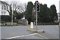
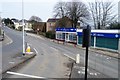
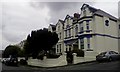
Photos of PL3 5AX


Area Information
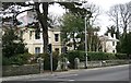
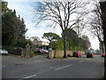
PL3 5AX occupies a specific residential cluster in Plymouth, England, covering an area of exactly 4,326 square metres. This postcode serves as a home to 1,516 people, creating a tightly knit community that sits compactly within the city fabric. The location is defined by its small footprint yet offers residents direct access to the wider amenities of the city centre. Living in PL3 5AX means balancing close-knightedness with urban convenience, as the area provides a gateway to Plymouth's railway stations and ferry terminals. The neighbourhood functions as a practical residential hub rather than a sprawling suburb, ensuring that daily commutes to key transport links are short. With a population density significant for its size, the area reflects a demand for proximity to services while maintaining distinct residential characteristics.
- Area Type
- Postcode
- Area Size
- 4326 m²
- Population
- 1516
- Population Density
- 7197 people/km²
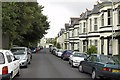
Homes in PL3 5AX are predominantly detached or semi-detached dwellings, given that the accommodation type is listed as houses. The area maintains a 50% home ownership rate, meaning exactly half of the 1,516 residents own their property outright or through a mortgage, while the other half rely on renting. This balance creates a market with low turnover compared to exclusive buy-to-let zones, yet more dynamic than pockets where ownership is near universal. Buyers looking at this specific postcode should expect a stock of family-sized properties designed for the age group now inhabiting them. The mix of owner-occupiers implies stability, as residents are less likely to move frequently unless their personal circumstances change drastically. When evaluating real estate in this small cluster, you will find properties that cater to established households rather than students or transient workers.
House Prices in PL3 5AX
Showing 18 properties
| Address | Type | Beds | Baths | Last Sale Price | Last Sale Date | |
|---|---|---|---|---|---|---|
| 48 Seymour Road, Mannamead, Plymouth, PL3 5AX | house | 1 | - | £220,000 | Mar 2009 | |
| Dunlewey Cottage, Seymour Road, Mannamead, Plymouth, PL3 5AX | Maisonette | 1 | 1 | £123,000 | Sep 2003 | |
| 52 Seymour Road, Mannamead, Plymouth, PL3 5AX | Semi-detached | - | - | £232,000 | Apr 2003 | |
| Flat 6, 46 Seymour Road, Mannamead, Plymouth, PL3 5AX | Flat | 1 | 1 | - | - | |
| 54 Seymour Road, Mannamead, Plymouth, PL3 5AX | Semi-detached | 4 | 1 | - | - | |
| Flat 9, 46 Seymour Road, Mannamead, Plymouth, PL3 5AX | Flat | 1 | 1 | - | - | |
| Flat 13, 46 Seymour Road, Mannamead, Plymouth, PL3 5AX | Flat | - | - | - | - | |
| Flat 8, 46 Seymour Road, Mannamead, Plymouth, PL3 5AX | Flat | - | - | - | - | |
| Flat 11, 46 Seymour Road, Mannamead, Plymouth, PL3 5AX | Flat | - | - | - | - | |
| Flat 1, 46 Seymour Road, Mannamead, Plymouth, PL3 5AX | Flat | - | - | - | - |
Energy Efficiency in PL3 5AX
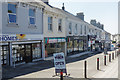
Living in PL3 5AX places you within practical reach of major retail and transport nodes across Plymouth. Five retail options await you, including Tesco Plymouth, Tesco Mutley, and Co-op Mutley, ensuring your weekly grocery requirements are met locally. Travel links are equally extensive, with five railway stations nearby: Plymouth Railway Station, Devonport Railway Station, and Dockyard Railway Station provide easy access to the national rail network. Furthermore, five ferry terminals, such as Plymouth Landing Stage and Plymouth Ferry Terminal, offer connections to the Channel Islands and mainland Europe. Two airports, specifically Plymouth City Airport, sit within the reachable circle for quick regional connections. This concentration of amenities means daily errands and longer journeys start with a short walk or drive from your doorstep.
Amenities
Schools
Western College Preparatory School is the notable institution situated near PL3 5AX. This independent school provides education options for families choosing private tuition over the state system. The presence of an independent school signals a choice for parents who prioritise specific educational curricula or facilities beyond the standard state offer. Since the data details only this single institution, the immediate educational landscape is defined by this one choice rather than a broad mix of primary, secondary, or academy schools. Families considering homes in this postcode must plan for travel to this specific facility, as no other school names appear in the local record. The availability of independent education adds a layer of choice for those who do not remain within the state school catchment areas surrounding the area.
| Rank | School | Type | Entry gender | Ages |
|---|
Explore more schools in this area
Go to Schools tabDemographics
The community within PL3 5AX skews older, with a median age of 47 years. Most residents fall into the adult bracket between 30 and 64 years, suggesting a population past the typical school-leaving age for young children. Half of the households here own their homes, indicating a stable, established population rather than a transient rental market. The predominant ethnic group is White, which aligns with the broader demographic trends of the region. Accommodation in this postcode consists primarily of houses, distinguishing it from areas dominated by flats or terraced housing. This housing mix supports family life and offers more internal space compared to high-density units elsewhere in the city. The demographic profile suggests a neighbourhood where long-term residents have settled down, contributing to a quiet, mature atmosphere consistent with a median age in the late forties.
Household Size
Accommodation Type
Tenure
Ethnic Group
Religion
Household Composition
Age
Household Deprivation
NS-SEC
Explore more demographic insights in this area
Go to Demographics tabPlanning
Planning Constraints
- Flood RiskPremium
- Ramsar Wetland SitesPremium
- Area of Outstanding Natural BeautyPremium
- Protected Nature ReservePremium
- Protected WoodlandPremium