Area Overview for PL3 4EP
Photos of PL3 4EP
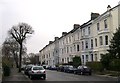
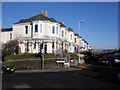
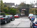
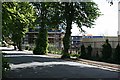

100 photos from this area
Area Information
Key information about the PL3 4EP including its size, population, and administrative classification.
- Area Type
- Postcode
- Area Size
- 1.4 hectares
- Population
- 1557
- Population Density
- 4700 people/km²
House Prices in PL3 4EP
35
Properties
£106,533
Average Sold Price
£71,000
Lowest Price
£170,350
Highest Price
Showing 35 properties
| Address | Type | Beds | Baths | Last Sale Price | Last Sale Date | |
|---|---|---|---|---|---|---|
| 71 Wingfield Road, Plymouth, PL3 4EP | Flat | - | - | £95,000 | Jul 2025 | |
| 111 Wingfield Road, Plymouth, PL3 4EP | Retail | 3 | 1 | £170,350 | Feb 2023 | |
| 40 Wingfield Road, Plymouth, PL3 4EP | house | - | - | £143,000 | Sep 2019 | |
| 69 Wingfield Road, Plymouth, PL3 4EP | Flat | - | - | £88,000 | Nov 2015 | |
| 113 Wingfield Road, Plymouth, PL3 4EP | house | - | - | £120,000 | Apr 2015 | |
| 67 Wingfield Road, Plymouth, PL3 4EP | Flat | - | - | £71,000 | Oct 2009 | |
| 109 Wingfield Road, Plymouth, PL3 4EP | Terraced | - | - | £102,000 | Oct 2008 | |
| 42 Wingfield Road, Plymouth, PL3 4EP | Terraced | 3 | 1 | £82,500 | Jul 2003 | |
| 44 Wingfield Road, Plymouth, PL3 4EP | house | - | - | £86,950 | Dec 2002 | |
| 63 Wingfield Road, Plymouth, PL3 4EP | Flat | - | - | - | - |
Page 1 of 4
Energy Efficiency in PL3 4EP
Amenities
Schools
| Rank | School | Type | Entry gender | Ages |
|---|
Explore more schools in this area
Go to Schools tabDemographics
Household Size
One person
most common
Accommodation Type
Houses
most common
Tenure
40
majority
Ethnic Group
White
most common
Religion
N/A
most common
Household Composition
N/A
most common
Age
47
median
Adults (30-64 years)
most common
Household Deprivation
N/A
with no deprivation
NS-SEC
23
in Lower managerial occupations
Explore more demographic insights in this area
Go to Demographics tabPlanning
Planning Constraints
- Flood RiskPremium
- Ramsar Wetland SitesPremium
- Area of Outstanding Natural BeautyPremium
- Protected Nature ReservePremium
- Protected WoodlandPremium