Area Overview for PL1 5LR
Photos of PL1 5LR
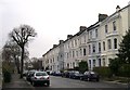
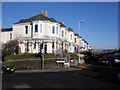
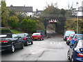
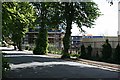


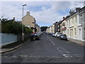

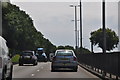
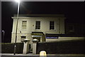
100 photos from this area
Area Information
Key information about the PL1 5LR including its size, population, and administrative classification.
- Area Type
- Postcode
- Area Size
- 1.0 hectares
- Population
- 1723
- Population Density
- 4179 people/km²
House Prices in PL1 5LR
7
Properties
£147,250
Average Sold Price
£77,000
Lowest Price
£210,000
Highest Price
Showing 7 properties
| Address | Type | Beds | Baths | Last Sale Price | Last Sale Date | |
|---|---|---|---|---|---|---|
| 130 Stuart Road, Plymouth, PL1 5LR | Terraced | 3 | 1 | £210,000 | Jul 2016 | |
| 132 Stuart Road, Plymouth, PL1 5LR | house | - | - | £190,000 | Jan 2007 | |
| 136 Stuart Road, Plymouth, PL1 5LR | Terraced | - | - | £112,000 | Oct 2005 | |
| 134 Stuart Road, Plymouth, PL1 5LR | house | 3 | - | £77,000 | Oct 2000 | |
| (former), 138A Stuart Road, Plymouth, PL1 5LR | undefined | - | - | - | - | |
| 138 Stuart Road, Plymouth, PL1 5LR | Terraced | - | - | - | - | |
| 144 Stuart Road, Plymouth, PL1 5LR | Semi-detached | - | - | - | - |
Energy Efficiency in PL1 5LR
Amenities
Schools
| Rank | School | Type | Entry gender | Ages |
|---|
Explore more schools in this area
Go to Schools tabDemographics
Household Size
One person
most common
Accommodation Type
Houses
most common
Tenure
53
majority
Ethnic Group
White
most common
Religion
N/A
most common
Household Composition
N/A
most common
Age
47
median
Adults (30-64 years)
most common
Household Deprivation
N/A
with no deprivation
NS-SEC
34
in Lower managerial occupations
Explore more demographic insights in this area
Go to Demographics tabPlanning
Planning Constraints
- Flood RiskPremium
- Ramsar Wetland SitesPremium
- Area of Outstanding Natural BeautyPremium
- Protected Nature ReservePremium
- Protected WoodlandPremium