Area Overview for PL25 3JE
Photos of PL25 3JE
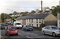
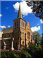

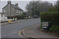
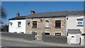
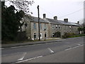
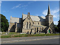
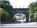
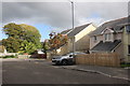
57 photos from this area
Area Information
Key information about the PL25 3JE including its size, population, and administrative classification.
- Area Type
- Postcode
- Area Size
- 1.3 hectares
- Population
- 1490
- Population Density
- 3414 people/km²
House Prices in PL25 3JE
23
Properties
£181,033
Average Sold Price
£59,000
Lowest Price
£260,000
Highest Price
Showing 23 properties
| Address | Type | Beds | Baths | Last Sale Price | Last Sale Date | |
|---|---|---|---|---|---|---|
| 24 Whieldon Road, St Austell, PL25 3JE | Bungalow | 2 | 1 | £260,000 | May 2021 | |
| 36 Whieldon Road, St Austell, PL25 3JE | Bungalow | 3 | - | £260,000 | Dec 2020 | |
| 42 Whieldon Road, St Austell, PL25 3JE | Bungalow | - | - | £231,500 | Aug 2020 | |
| 38 Whieldon Road, St Austell, PL25 3JE | Bungalow | 3 | 1 | £225,000 | Dec 2019 | |
| 29 Whieldon Road, St Austell, PL25 3JE | Bungalow | - | - | £220,000 | Apr 2018 | |
| 30 Whieldon Road, St Austell, PL25 3JE | Bungalow | 3 | - | £185,950 | Sep 2016 | |
| 28 Whieldon Road, St Austell, PL25 3JE | Bungalow | 4 | - | £222,000 | Jun 2016 | |
| 37 Whieldon Road, St Austell, PL25 3JE | Bungalow | 2 | - | £162,000 | Apr 2015 | |
| 39 Whieldon Road, St Austell, PL25 3JE | Bungalow | - | - | £159,950 | Jun 2013 | |
| 41 Whieldon Road, St Austell, PL25 3JE | Bungalow | - | - | £120,000 | Jan 2006 |
Page 1 of 3
Energy Efficiency in PL25 3JE
Amenities
Schools
| Rank | School | Type | Entry gender | Ages |
|---|
Explore more schools in this area
Go to Schools tabDemographics
Household Size
Two person
most common
Accommodation Type
Houses
most common
Tenure
79
majority
Ethnic Group
White
most common
Religion
N/A
most common
Household Composition
N/A
most common
Age
47
median
Adults (30-64 years)
most common
Household Deprivation
N/A
with no deprivation
NS-SEC
26
in Lower managerial occupations
Explore more demographic insights in this area
Go to Demographics tabPlanning
Planning Constraints
- Flood RiskPremium
- Ramsar Wetland SitesPremium
- Area of Outstanding Natural BeautyPremium
- Protected Nature ReservePremium
- Protected WoodlandPremium