Area Overview for PL25 3JA
Photos of PL25 3JA
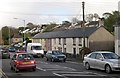
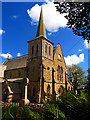
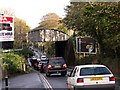
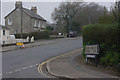
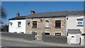
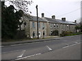
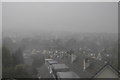
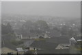
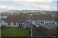

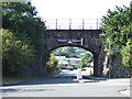
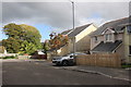
57 photos from this area
Area Information
Key information about the PL25 3JA including its size, population, and administrative classification.
- Area Type
- Postcode
- Area Size
- 1.1 hectares
- Population
- 1490
- Population Density
- 3414 people/km²
House Prices in PL25 3JA
22
Properties
£219,377
Average Sold Price
£130,000
Lowest Price
£330,000
Highest Price
Showing 22 properties
| Address | Type | Beds | Baths | Last Sale Price | Last Sale Date | |
|---|---|---|---|---|---|---|
| 1 Doulton Road, St Austell, PL25 3JA | Bungalow | 3 | 1 | £325,000 | Nov 2023 | |
| 5 Doulton Road, St Austell, PL25 3JA | Bungalow | 4 | 2 | £330,000 | Jul 2023 | |
| 4 Doulton Road, St Austell, PL25 3JA | Semi-detached | 2 | 1 | £306,000 | Sep 2022 | |
| 7 Doulton Road, St Austell, PL25 3JA | Bungalow | - | - | £250,000 | Sep 2020 | |
| 12 Doulton Road, St Austell, PL25 3JA | Bungalow | 2 | - | £200,000 | Nov 2017 | |
| 15 Doulton Road, St Austell, PL25 3JA | Bungalow | 2 | - | £159,000 | Jan 2017 | |
| 22 Doulton Road, St Austell, PL25 3JA | Bungalow | 2 | - | £184,000 | Dec 2013 | |
| 11 Doulton Road, St Austell, PL25 3JA | Bungalow | 3 | - | £176,000 | Sep 2013 | |
| 9 Doulton Road, St Austell, PL25 3JA | Detached | - | - | £179,950 | Apr 2006 | |
| 19 Doulton Road, St Austell, PL25 3JA | Detached | - | - | £230,000 | Mar 2006 |
Page 1 of 3
Energy Efficiency in PL25 3JA
Amenities
Schools
| Rank | School | Type | Entry gender | Ages |
|---|
Explore more schools in this area
Go to Schools tabDemographics
Household Size
Two person
most common
Accommodation Type
Houses
most common
Tenure
79
majority
Ethnic Group
White
most common
Religion
N/A
most common
Household Composition
N/A
most common
Age
47
median
Adults (30-64 years)
most common
Household Deprivation
N/A
with no deprivation
NS-SEC
26
in Lower managerial occupations
Explore more demographic insights in this area
Go to Demographics tabPlanning
Planning Constraints
- Flood RiskPremium
- Ramsar Wetland SitesPremium
- Area of Outstanding Natural BeautyPremium
- Protected Nature ReservePremium
- Protected WoodlandPremium