Area Overview for PL25 3HE
Photos of PL25 3HE
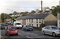
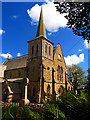
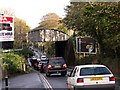
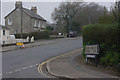
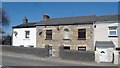
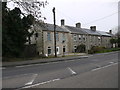
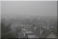
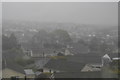
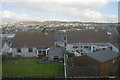
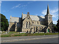
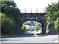
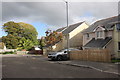
57 photos from this area
Area Information
Key information about the PL25 3HE including its size, population, and administrative classification.
- Area Type
- Postcode
- Area Size
- 8113 m²
- Population
- 1490
- Population Density
- 3414 people/km²
House Prices in PL25 3HE
28
Properties
£161,880
Average Sold Price
£70,000
Lowest Price
£240,000
Highest Price
Showing 28 properties
| Address | Type | Beds | Baths | Last Sale Price | Last Sale Date | |
|---|---|---|---|---|---|---|
| 28 Fairfield Close, St Austell, PL25 3HE | Semi-detached | 3 | 1 | £70,000 | May 2024 | |
| 26 Fairfield Close, St Austell, PL25 3HE | Detached | 3 | 1 | £220,000 | Dec 2022 | |
| 15 Fairfield Close, St Austell, PL25 3HE | Terraced | 3 | 1 | £240,000 | Sep 2021 | |
| 22 Fairfield Close, St Austell, PL25 3HE | Semi-detached | 4 | 1 | £213,000 | Feb 2019 | |
| 2 Fairfield Close, St Austell, PL25 3HE | Semi-detached | 3 | 1 | £161,105 | Apr 2018 | |
| 8 Fairfield Close, St Austell, PL25 3HE | house | - | - | £135,000 | May 2017 | |
| 17 Fairfield Close, St Austell, PL25 3HE | Semi-detached | 5 | 2 | £237,000 | Apr 2017 | |
| 20 Fairfield Close, St Austell, PL25 3HE | house | - | - | £145,000 | Jul 2016 | |
| 11 Fairfield Close, St Austell, PL25 3HE | Semi-detached | 3 | 1 | £132,000 | Aug 2015 | |
| 32 Fairfield Close, St Austell, PL25 3HE | house | 2 | - | £140,000 | Aug 2015 |
Page 1 of 3
Energy Efficiency in PL25 3HE
Amenities
Schools
| Rank | School | Type | Entry gender | Ages |
|---|
Explore more schools in this area
Go to Schools tabDemographics
Household Size
Two person
most common
Accommodation Type
Houses
most common
Tenure
79
majority
Ethnic Group
White
most common
Religion
N/A
most common
Household Composition
N/A
most common
Age
47
median
Adults (30-64 years)
most common
Household Deprivation
N/A
with no deprivation
NS-SEC
26
in Lower managerial occupations
Explore more demographic insights in this area
Go to Demographics tabPlanning
Planning Constraints
- Flood RiskPremium
- Ramsar Wetland SitesPremium
- Area of Outstanding Natural BeautyPremium
- Protected Nature ReservePremium
- Protected WoodlandPremium