Area Overview for PL25 3HB
Photos of PL25 3HB
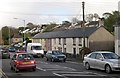
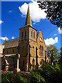
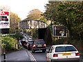
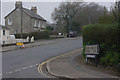
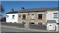
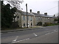
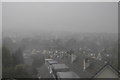
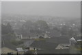
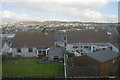
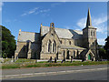
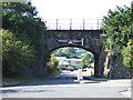
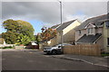
57 photos from this area
Area Information
Key information about the PL25 3HB including its size, population, and administrative classification.
- Area Type
- Postcode
- Area Size
- 1.2 hectares
- Population
- 1490
- Population Density
- 3414 people/km²
House Prices in PL25 3HB
20
Properties
£182,227
Average Sold Price
£35,000
Lowest Price
£379,950
Highest Price
Showing 20 properties
| Address | Type | Beds | Baths | Last Sale Price | Last Sale Date | |
|---|---|---|---|---|---|---|
| 29 Bethel Road, St Austell, PL25 3HB | Bungalow | 4 | 2 | £245,000 | Sep 2025 | |
| 36 Bethel Road, St Austell, PL25 3HB | Bungalow | 2 | 1 | £148,500 | Aug 2024 | |
| 27 Bethel Road, St Austell, PL25 3HB | Bungalow | 2 | 1 | £155,000 | Mar 2024 | |
| 26 Bethel Road, St Austell, PL25 3HB | Bungalow | 3 | 2 | £379,950 | Nov 2022 | |
| 24 Bethel Road, St Austell, PL25 3HB | Detached | 2 | 1 | £255,000 | Jan 2022 | |
| 32 Bethel Road, St Austell, PL25 3HB | house | - | - | £325,000 | May 2021 | |
| 25 Bethel Road, St Austell, PL25 3HB | Bungalow | 3 | 1 | £254,000 | Mar 2020 | |
| 41 Bethel Road, St Austell, PL25 3HB | Terraced | 3 | 1 | £125,000 | Oct 2019 | |
| 40 Bethel Road, St Austell, PL25 3HB | Bungalow | 2 | - | £102,000 | Jul 2017 | |
| 28 Bethel Road, St Austell, PL25 3HB | Bungalow | 3 | - | £232,000 | Oct 2012 |
Page 1 of 2
Energy Efficiency in PL25 3HB
Amenities
Schools
| Rank | School | Type | Entry gender | Ages |
|---|
Explore more schools in this area
Go to Schools tabDemographics
Household Size
Two person
most common
Accommodation Type
Houses
most common
Tenure
79
majority
Ethnic Group
White
most common
Religion
N/A
most common
Household Composition
N/A
most common
Age
47
median
Adults (30-64 years)
most common
Household Deprivation
N/A
with no deprivation
NS-SEC
26
in Lower managerial occupations
Explore more demographic insights in this area
Go to Demographics tabPlanning
Planning Constraints
- Flood RiskPremium
- Ramsar Wetland SitesPremium
- Area of Outstanding Natural BeautyPremium
- Protected Nature ReservePremium
- Protected WoodlandPremium