Area Overview for PL20 7SP
Photos of PL20 7SP
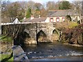
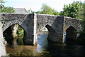
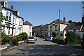
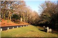

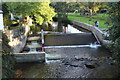
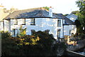
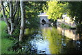
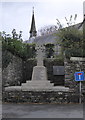
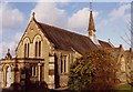
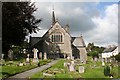
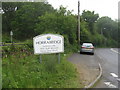
35 photos from this area
Area Information
Key information about the PL20 7SP including its size, population, and administrative classification.
- Area Type
- Postcode
- Area Size
- 1.5 hectares
- Population
- 1651
- Population Density
- 53 people/km²
House Prices in PL20 7SP
27
Properties
£180,410
Average Sold Price
£22,350
Lowest Price
£380,000
Highest Price
Showing 27 properties
| Address | Type | Beds | Baths | Last Sale Price | Last Sale Date | |
|---|---|---|---|---|---|---|
| 30 Chapel Lane, Horrabridge, PL20 7SP | Bungalow | 3 | 1 | £380,000 | Sep 2024 | |
| 28 Chapel Lane, Horrabridge, PL20 7SP | Bungalow | 3 | 1 | £310,000 | Jan 2023 | |
| Rivercote, Chapel Lane, Horrabridge, PL20 7SP | house | - | - | £345,000 | Jul 2022 | |
| 4 Chapel Lane, Horrabridge, PL20 7SP | Terraced | 2 | 1 | £147,500 | Dec 2019 | |
| The Hollies, 16 Chapel Lane, Horrabridge, PL20 7SP | Bungalow | 3 | 3 | £279,950 | Jul 2019 | |
| Bramble Cottage, 6 Chapel Lane, Horrabridge, PL20 7SP | house | - | - | £85,350 | Dec 2016 | |
| Redavon, 20 Chapel Lane, Horrabridge, PL20 7SP | Bungalow | 2 | 1 | £225,000 | May 2014 | |
| 18 Chapel Lane, Horrabridge, PL20 7SP | Bungalow | 3 | - | £245,000 | Jul 2013 | |
| Whitehaven, Chapel Lane, Horrabridge, PL20 7SP | house | 2 | - | £145,000 | Oct 2012 | |
| 12 Chapel Lane, Horrabridge, PL20 7SP | house | - | - | £118,000 | Sep 2010 |
Page 1 of 3
Energy Efficiency in PL20 7SP
Amenities
Schools
| Rank | School | Type | Entry gender | Ages |
|---|
Explore more schools in this area
Go to Schools tabDemographics
Household Size
Two person
most common
Accommodation Type
Houses
most common
Tenure
88
majority
Ethnic Group
White
most common
Religion
N/A
most common
Household Composition
N/A
most common
Age
47
median
Adults (30-64 years)
most common
Household Deprivation
N/A
with no deprivation
NS-SEC
43
in Lower managerial occupations
Explore more demographic insights in this area
Go to Demographics tabPlanning
Planning Constraints
- Flood RiskPremium
- Ramsar Wetland SitesPremium
- Area of Outstanding Natural BeautyPremium
- Protected Nature ReservePremium
- Protected WoodlandPremium