Area Overview for PL20 7SG
Photos of PL20 7SG
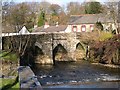
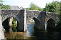
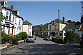
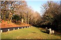

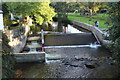
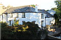
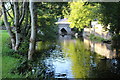
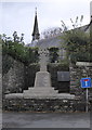


35 photos from this area
Area Information
Key information about the PL20 7SG including its size, population, and administrative classification.
- Area Type
- Postcode
- Area Size
- 3899 m²
- Population
- 1547
- Population Density
- 1321 people/km²
House Prices in PL20 7SG
10
Properties
£177,139
Average Sold Price
£154,950
Lowest Price
£263,500
Highest Price
Showing 10 properties
| Address | Type | Beds | Baths | Last Sale Price | Last Sale Date | |
|---|---|---|---|---|---|---|
| 16 Pencreber Road, Horrabridge, PL20 7SG | Semi-detached | 3 | 1 | £263,500 | Jan 2024 | |
| 28 Pencreber Road, Horrabridge, PL20 7SG | house | - | - | £205,000 | Mar 2021 | |
| 22 Pencreber Road, Horrabridge, PL20 7SG | house | 3 | - | £178,000 | Oct 2016 | |
| 32 Pencreber Road, Horrabridge, PL20 7SG | Semi-detached | - | - | £154,950 | Jan 2006 | |
| 20 Pencreber Road, Horrabridge, PL20 7SG | Semi-detached | - | - | £156,950 | Dec 2005 | |
| 18 Pencreber Road, Horrabridge, PL20 7SG | Semi-detached | - | - | £158,950 | Dec 2005 | |
| 34 Pencreber Road, Horrabridge, PL20 7SG | Detached | - | - | £164,000 | Dec 2005 | |
| 24 Pencreber Road, Horrabridge, PL20 7SG | Semi-detached | - | - | £157,950 | Aug 2005 | |
| 30 Pencreber Road, Horrabridge, PL20 7SG | Semi-detached | - | - | £154,950 | Jul 2005 | |
| 26 Pencreber Road, Horrabridge, PL20 7SG | Semi-detached | - | - | - | - |
Energy Efficiency in PL20 7SG
Amenities
Schools
| Rank | School | Type | Entry gender | Ages |
|---|
Explore more schools in this area
Go to Schools tabDemographics
Household Size
Two person
most common
Accommodation Type
Houses
most common
Tenure
64
majority
Ethnic Group
White
most common
Religion
N/A
most common
Household Composition
N/A
most common
Age
47
median
Adults (30-64 years)
most common
Household Deprivation
N/A
with no deprivation
NS-SEC
30
in Lower managerial occupations
Explore more demographic insights in this area
Go to Demographics tabPlanning
Planning Constraints
- Flood RiskPremium
- Ramsar Wetland SitesPremium
- Area of Outstanding Natural BeautyPremium
- Protected Nature ReservePremium
- Protected WoodlandPremium