Area Overview for PL20 6DR
Photos of PL20 6DR
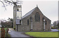
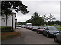
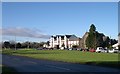
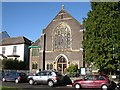
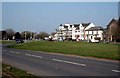
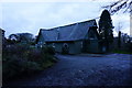


73 photos from this area
Area Information
Key information about the PL20 6DR including its size, population, and administrative classification.
- Area Type
- Postcode
- Area Size
- 8581 m²
- Population
- 1613
- Population Density
- 121 people/km²
House Prices in PL20 6DR
7
Properties
£434,238
Average Sold Price
£71,000
Lowest Price
£835,000
Highest Price
Showing 7 properties
| Address | Type | Beds | Baths | Last Sale Price | Last Sale Date | |
|---|---|---|---|---|---|---|
| Carriages, Greenbank Terrace, Yelverton, PL20 6DR | house | 5 | - | £835,000 | Feb 2021 | |
| 5 Greenbank Terrace, Yelverton, PL20 6DR | Terraced | 5 | 3 | £457,950 | Nov 2019 | |
| Hayesleigh, 7 Greenbank Terrace, Yelverton, PL20 6DR | house | - | - | £373,000 | Jul 2014 | |
| 6 Greenbank Terrace, Yelverton, PL20 6DR | Terraced | - | - | £71,000 | Oct 2000 | |
| Fernleigh, 4 Greenbank Terrace, Yelverton, PL20 6DR | Retirement | - | - | - | - | |
| Sheepstor View, 1 Greenbank Terrace, Yelverton, PL20 6DR | Terraced | - | - | - | - | |
| Yelverton Care Llp, The Yelverton Nursing And Residential Home, 2-4 Greenbank Terrace, Yelverton, PL20 6DR | hospital_care_home | - | - | - | - |
Energy Efficiency in PL20 6DR
Amenities
Schools
| Rank | School | Type | Entry gender | Ages |
|---|
Explore more schools in this area
Go to Schools tabDemographics
Household Size
Two person
most common
Accommodation Type
Houses
most common
Tenure
66
majority
Ethnic Group
White
most common
Religion
N/A
most common
Household Composition
N/A
most common
Age
47
median
Adults (30-64 years)
most common
Household Deprivation
N/A
with no deprivation
NS-SEC
41
in Lower managerial occupations
Explore more demographic insights in this area
Go to Demographics tabPlanning
Planning Constraints
- Flood RiskPremium
- Ramsar Wetland SitesPremium
- Area of Outstanding Natural BeautyPremium
- Protected Nature ReservePremium
- Protected WoodlandPremium