Area Overview for PL20 6AS
Photos of PL20 6AS
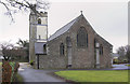
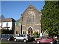
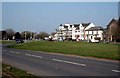
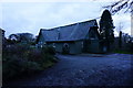
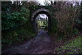
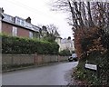
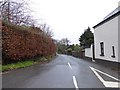
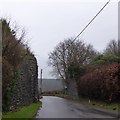

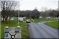
73 photos from this area
Area Information
Key information about the PL20 6AS including its size, population, and administrative classification.
- Area Type
- Postcode
- Area Size
- 2.5 hectares
- Population
- 1820
- Population Density
- 146 people/km²
House Prices in PL20 6AS
16
Properties
£478,896
Average Sold Price
£136,000
Lowest Price
£715,000
Highest Price
Showing 16 properties
| Address | Type | Beds | Baths | Last Sale Price | Last Sale Date | |
|---|---|---|---|---|---|---|
| Oakwood, Westella Road, Yelverton, PL20 6AS | Bungalow | 3 | - | £675,000 | Jun 2025 | |
| Merrivale, Westella Road, Yelverton, PL20 6AS | Bungalow | 4 | 2 | £655,000 | Aug 2024 | |
| Swithland, Westella Road, Yelverton, PL20 6AS | house | - | - | £644,500 | Apr 2023 | |
| Seymour House, Westella Road, Yelverton, PL20 6AS | house | - | - | £715,000 | Apr 2023 | |
| Brynmoor, Westella Road, Yelverton, PL20 6AS | house | - | - | £550,000 | Apr 2022 | |
| Carrickmore, Westella Road, Yelverton, PL20 6AS | Bungalow | - | - | £483,500 | Jun 2020 | |
| Sarnia, Westella Road, Yelverton, PL20 6AS | house | - | - | £490,000 | Jul 2018 | |
| Ashdown, Westella Road, Yelverton, PL20 6AS | Detached | 5 | - | £519,250 | Jun 2013 | |
| The Beeches, Westella Road, Yelverton, PL20 6AS | house | 3 | - | £160,000 | Oct 2011 | |
| Karingal, Westella Road, Yelverton, PL20 6AS | Bungalow | - | - | £452,500 | Feb 2008 |
Page 1 of 2
Energy Efficiency in PL20 6AS
Amenities
Schools
| Rank | School | Type | Entry gender | Ages |
|---|
Explore more schools in this area
Go to Schools tabDemographics
Household Size
Two person
most common
Accommodation Type
Houses
most common
Tenure
85
majority
Ethnic Group
White
most common
Religion
N/A
most common
Household Composition
N/A
most common
Age
47
median
Adults (30-64 years)
most common
Household Deprivation
N/A
with no deprivation
NS-SEC
49
in Lower managerial occupations
Explore more demographic insights in this area
Go to Demographics tabPlanning
Planning Constraints
- Flood RiskPremium
- Ramsar Wetland SitesPremium
- Area of Outstanding Natural BeautyPremium
- Protected Nature ReservePremium
- Protected WoodlandPremium