Area Overview for PL19 9AH
Photos of PL19 9AH
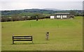
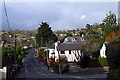
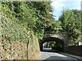
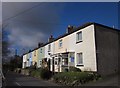


12 photos from this area
Area Information
Key information about the PL19 9AH including its size, population, and administrative classification.
- Area Type
- Postcode
- Area Size
- 3.3 hectares
- Population
- 1623
- Population Density
- 1855 people/km²
House Prices in PL19 9AH
31
Properties
£443,471
Average Sold Price
£130,000
Lowest Price
£632,500
Highest Price
Showing 31 properties
| Address | Type | Beds | Baths | Last Sale Price | Last Sale Date | |
|---|---|---|---|---|---|---|
| 3 Lang Grove, Tavistock, PL19 9AH | Bungalow | 3 | 2 | £570,000 | May 2024 | |
| 2 Lang Grove, Tavistock, PL19 9AH | Bungalow | 3 | 2 | £460,000 | Jan 2024 | |
| Langmead, Down Park Drive, Tavistock, PL19 9AH | Bungalow | - | - | £425,000 | Jun 2021 | |
| 1 Lang Grove, Tavistock, PL19 9AH | Bungalow | - | - | £521,000 | Jun 2021 | |
| Gajon Lodge, Down Park Drive, Tavistock, PL19 9AH | Bungalow | - | - | £535,000 | Jul 2020 | |
| Rill House, Down Park Drive, Tavistock, PL19 9AH | Detached | 4 | 2 | £632,500 | Mar 2019 | |
| Lindenfels, Down Park Drive, Tavistock, PL19 9AH | Bungalow | 3 | 2 | £347,500 | Aug 2015 | |
| Coulin, Down Park Drive, Tavistock, PL19 9AH | house | - | - | £454,000 | Jan 2015 | |
| Waldesruh, Down Park Drive, Tavistock, PL19 9AH | Detached | 4 | - | £495,000 | Jul 2014 | |
| Lumburn, Down Park Drive, Tavistock, PL19 9AH | Detached | 5 | 3 | £629,000 | Jul 2014 |
Page 1 of 4
Energy Efficiency in PL19 9AH
Amenities
Schools
| Rank | School | Type | Entry gender | Ages |
|---|
Explore more schools in this area
Go to Schools tabDemographics
Household Size
Two person
most common
Accommodation Type
Houses
most common
Tenure
78
majority
Ethnic Group
White
most common
Religion
N/A
most common
Household Composition
N/A
most common
Age
47
median
Elderly (65+ years)
most common
Household Deprivation
N/A
with no deprivation
NS-SEC
38
in Lower managerial occupations
Explore more demographic insights in this area
Go to Demographics tabPlanning
Planning Constraints
- Flood RiskPremium
- Ramsar Wetland SitesPremium
- Area of Outstanding Natural BeautyPremium
- Protected Nature ReservePremium
- Protected WoodlandPremium