Area Overview for PL11 2HP
Photos of PL11 2HP


Area Information
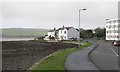
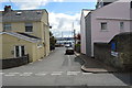
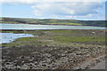
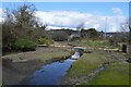
Living in PL11 2HP offers a specific residential experience defined by its compact nature and established character. This postcode covers a precise 7,140 square metres of land, housing a population of 1,515 people. The density is high, with approximately 212,000 people per square kilometre, indicating a tightly knit neighbourhood rather than a sprawling sprawl. You will find a community where proximity is key, fostering a sense of familiarity among neighbours. The area represents a small residential cluster within the broader Torpoint landscape. Residents here typically enjoy a settled life, anchored by the immediate local environment. Daily routines revolve around accessible nearby facilities rather than long commutes across town. The geographic scale is modest, meaning that walking or cycling often suffices for essential trips. This postcode does not sprawl; it concentrates. For those purchasing homes in PL11 2HP, the defining feature is this intense localisation. The area functions as a distinct pocket of residential living, separate from but connected to larger transport hubs nearby. You are stepping into a place where community boundaries are clear and the pace of life reflects its manageable size.
- Area Type
- Postcode
- Area Size
- 7140 m²
- Population
- 1515
- Population Density
- 5248 people/km²
The property market in PL11 2HP is characterised by a stronghold of owner-occupancy rather than a rental economy. Data confirms that 77% of residents own their homes, indicating a robust fabric of long-term residents. The accommodation type presented is houses, meaning the housing stock is designed for families or couples seeking traditional residential structures. This exclusion of flats points to a market where character and space are prioritised over density. Buyers looking at this small area will find a limited but specific selection of properties. The high ownership percentage suggests that active development or turnover is driven by sale rather than tenancy. This environment is stable for purchasing. Existing owners comprise the vast majority of the population, which often correlates with better-maintained housing. When you consider homes in PL11 2HP, you are not competing in a volatile student rental market but in a settled residential sector. The scarcity of flats also means competition is generally between households seeking similar family-sized dwellings. This market structure supports a consistent demand for houses over other property types.
House Prices in PL11 2HP
Showing 28 properties
| Address | Type | Beds | Baths | Last Sale Price | Last Sale Date | |
|---|---|---|---|---|---|---|
| 25 Carbeile Road, Torpoint, PL11 2HP | Terraced | 3 | 1 | £220,000 | Oct 2025 | |
| 31 Carbeile Road, Torpoint, PL11 2HP | Terraced | 3 | 1 | £220,000 | Mar 2025 | |
| 53 Carbeile Road, Torpoint, PL11 2HP | Terraced | 2 | 1 | £180,000 | Oct 2024 | |
| 49 Carbeile Road, Torpoint, PL11 2HP | Terraced | 3 | 1 | £170,000 | Feb 2024 | |
| 43 Carbeile Road, Torpoint, PL11 2HP | Terraced | 2 | 1 | £138,000 | Jun 2017 | |
| 45 Carbeile Road, Torpoint, PL11 2HP | Terraced | 3 | - | £133,000 | Feb 2015 | |
| 22 Carbeile Road, Torpoint, PL11 2HP | house | 3 | - | £137,000 | Jul 2014 | |
| 37 Carbeile Road, Torpoint, PL11 2HP | Terraced | 3 | - | £166,500 | Jul 2014 | |
| 19 Carbeile Road, Torpoint, PL11 2HP | house | 3 | - | £140,000 | May 2012 | |
| 39 Carbeile Road, Torpoint, PL11 2HP | Terraced | 2 | 2 | £117,000 | Sep 2009 |
Energy Efficiency in PL11 2HP
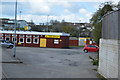
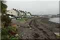
Your daily lifestyle in PL11 2HP is supported by a cluster of practical amenities within walking or short driving distance. Five retail outlets are available, including Sainsburys Torpoint, Spar, and the Co-op Torpoint. These shops ensure you can purchase groceries and essentials without travelling far. Transport links are also plentiful, with five ferry terminals nearby, including Torpoint Ferry Terminal and Cawsand Beach Ferry Landing Pier. If you intend to travel to Newquay or similar destinations by boat, these points of departure are key assets. Rail connectivity is accessible through stations such as Dockyard Railway Station, Devonport Railway Station, and Keyham Railway Station, providing quick access to Plymouth and beyond. Two airports, both noted as Plymouth City Airport, offer flight options for your needs. This density of services means you live in a convenient pocket of Cornwall. You do not need a car for basic tasks; the Sainsburys and Spar stores are just a short trip away. The ferry terminals add a distinct Cornwall-specific dimension to your routine. Using the nearby rail stations allows you to commute to work in the city centre efficiently. Living here means having your shops and transit everywhere in reach.
Amenities
Schools
Families purchasing homes in PL11 2HP have access to specific educational institutions within reasonable reach. The nearest school is Torpoint Community College, which is listed as a primary school in the data. It holds a Good Ofsted rating, indicating a standard of education that meets government expectations. This single listing defines the immediate educational landscape for the postcode. For larger families or those seeking secondary education, options lie slightly further away or within the broader Torpoint area. The classification of the nearby institution as a primary school suggests that very young children attend this facility, while older students likely move to other establishments not detailed in the restricted dataset. You must verify secondary options separately if your children are growing. The presence of a Good rated primary school provides a solid foundation for early education. Living in PL11 2HP connects you immediately to this recognised primary provider. While the data limits the view to one specific school, the rating offers reassurance regarding the quality of local childhood education.
| Rank | School | Type | Entry gender | Ages |
|---|
Explore more schools in this area
Go to Schools tabDemographics
The community in PL11 2HP reflects a mature and stable population structure. The median age stands at 47, firmly placing the area within the adulthood life stage. Most residents fall into the 30 to 64 years age range, suggesting families with children or young adults establishing careers dominate the landscape. Home ownership is the prevailing norm, with 77% of households owning their property outright or with a mortgage. This high ownership rate signals long-term settlement and investment in the locality. The accommodation type consists almost exclusively of houses, catering to families and those seeking traditional living spaces rather than flats. White residents form the predominant ethnic group within this postcode. The demographic profile indicates a neighbourhood built for permanence. With such a high proportion of owner-occupiers, the street-level atmosphere is likely shaped by individuals who have stakes in the long-term maintenance and development of their homes. This stability is evident in the age profile and property tenure. You are buying into a community of established adults, not a transient rental population.
Household Size
Accommodation Type
Tenure
Ethnic Group
Religion
Household Composition
Age
Household Deprivation
NS-SEC
Explore more demographic insights in this area
Go to Demographics tabPlanning
Planning Constraints
- Flood RiskPremium
- Ramsar Wetland SitesPremium
- Area of Outstanding Natural BeautyPremium
- Protected Nature ReservePremium
- Protected WoodlandPremium