Area Overview for PL11 2DZ
Photos of PL11 2DZ
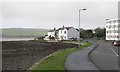
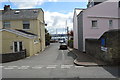
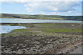
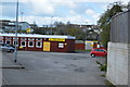
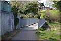
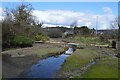
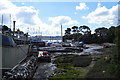
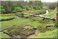
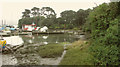
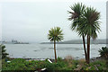
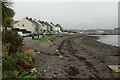
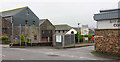
40 photos from this area
Area Information
Key information about the PL11 2DZ including its size, population, and administrative classification.
- Area Type
- Postcode
- Area Size
- 5714 m²
- Population
- 1122
- Population Density
- 5555 people/km²
House Prices in PL11 2DZ
14
Properties
£163,675
Average Sold Price
£65,950
Lowest Price
£235,000
Highest Price
Showing 14 properties
| Address | Type | Beds | Baths | Last Sale Price | Last Sale Date | |
|---|---|---|---|---|---|---|
| 64 Cremyll Road, Torpoint, PL11 2DZ | Semi-detached | 3 | 1 | £235,000 | Jul 2023 | |
| 58 Cremyll Road, Torpoint, PL11 2DZ | Semi-detached | 3 | 2 | £189,950 | Jul 2020 | |
| 55 Cremyll Road, Torpoint, PL11 2DZ | Semi-detached | 3 | 1 | £167,500 | Jul 2020 | |
| 53 Cremyll Road, Torpoint, PL11 2DZ | Semi-detached | 3 | 1 | £183,000 | Feb 2020 | |
| 61 Cremyll Road, Torpoint, PL11 2DZ | house | 3 | 1 | £178,000 | Jan 2016 | |
| 51 Cremyll Road, Torpoint, PL11 2DZ | Semi-detached | 3 | 1 | £135,000 | Aug 2007 | |
| 63 Cremyll Road, Torpoint, PL11 2DZ | Terraced | - | - | £155,000 | Apr 2006 | |
| 56 Cremyll Road, Torpoint, PL11 2DZ | house | - | - | £65,950 | Mar 2002 | |
| 59 Cremyll Road, Torpoint, PL11 2DZ | Semi-detached | - | - | - | - | |
| 62 Cremyll Road, Torpoint, PL11 2DZ | Terraced | - | - | - | - |
Page 1 of 2
Energy Efficiency in PL11 2DZ
Amenities
Schools
| Rank | School | Type | Entry gender | Ages |
|---|
Explore more schools in this area
Go to Schools tabDemographics
Household Size
One person
most common
Accommodation Type
Houses
most common
Tenure
49
majority
Ethnic Group
White
most common
Religion
N/A
most common
Household Composition
N/A
most common
Age
47
median
Adults (30-64 years)
most common
Household Deprivation
N/A
with no deprivation
NS-SEC
22
in Lower managerial occupations
Explore more demographic insights in this area
Go to Demographics tabPlanning
Planning Constraints
- Flood RiskPremium
- Ramsar Wetland SitesPremium
- Area of Outstanding Natural BeautyPremium
- Protected Nature ReservePremium
- Protected WoodlandPremium